An Apple Pie From Scratch, Part VIIb: Geology and Landforms: Erosion and Deposition
 |
| Tower karst along the Li River, China. chensiyuan, Wikimedia |
As tectonic forces work to raise land (well, not always, but they are the main forces that do so) erosional forces are constantly working to flatten it out again. For various reasons they rarely do so perfectly or evenly, and the many specific interactions of tectonics and different erosional forces leads to the diversity of terrains we have on Earth today.
One important point to emphasize is that geology is a dynamic process, and the world we see today is a snapshot of many ongoing processes of transition and change. Many areas have terrain that looks nothing like what we’d expect to see once erosion had fully run its course, and some have been shaped by erosional forces that are no longer active today. Rivers may follow courses not possible had they started carving out channels today, mountains may stand long after the tectonic forces responsible for them have died away, and deserts may bear the scars of seas and rivers that no longer exist. I won’t get into all the ways different forces and processes may interact here, but bear in mind that no landform exists in isolation and may exist at any point in a dozen overlapping states of transition.
As with the last post, I’ll run through a list of the most common or notable landforms caused specifically by erosion and deposition, describing their general location, appearance, dimensions, and any ecological or social impacts.
Types of Erosion
There are numerous types of erosion which work in various ways, but generally speaking rock or sediment that is more exposed tends to be removed, broken down—usually into clasts, fragments of rock, but sometimes completely dissolved in water or other fluids—and then transported until it arrives in a more sheltered region, where it is deposited. Because gravity plays some role in most erosion processes, the tendency is for material to move downhill, such that higher regions are eroded down and lower regions are filled in, and all regions trend towards a flat plain (though there are various exceptions and nuances).
But elevation isn’t the only factor here; a small outcrop in a lowland plain may be eroding down, while an isolated valley in the highlands may be filling in with sediment.
To avoid any confusion, I’ll divide the surface into source regions, which are losing material on average, and destination regions, which are gaining material on average. There’s a bit of grey area, and the dividing line between these can shift with the seasons or even with the daily weather; but in general it’s an easily identified distinction that we can find in any type of terrain, and in many cases we can identify a fall line on the flanks of mountains, where steep source terrain gives way to flatter destination terrain.
We can also define a base level, which is the elevation below which erosion essentially stops, because there are no available destination regions below that level where material can be moved into (e.g., once a pebble rolls down to the nadir of a valley, there’s nowhere lower for it to go). For much of the world this is sea level (sort of; erosive forces on the sea bottom will continue to move material to deeper areas, but the dominant erosive forces on land will generally stop once they reach sea level, and the former are much stronger), but in many areas it can be much higher, or in a few cases even lower.
Any given part of the world will be influenced by multiple erosive forces, but for our purposes, I’ll break down the world’s terrain into 4 major categories dominated by different main erosive forces (each containing their own internal source and destination regions):
- Fluvial terrain dominated by erosion from
the movement of liquid water in the form of rain, runoff, streams, rivers, and
lakes.
- Glacial terrain dominated by erosion from
the formation and movement of ice in the form of snow and glaciers, or
meltwater flowing directly off those glaciers.
- Eolian terrain dominated by wind erosion
in the absence of strong fluvial or glacial erosion.
- Coastal terrain dominated by erosion from waves, tides, and other processes unique to coastlines.
Again, many areas are affected by a combination of these
erosive forces, and some features arise specifically from their interaction—and
bear in mind that, as with mountains in the last part, this categorization is
my own invention, and a formal geological classification scheme would probably
include a lot more nuance. Erosion can also be driven by plant growth, animal
activity, mass wasting (gradual collapse of slopes due to gravity after being weakened by other forces), seasonal and daily
shifts in temperature and ice formation, earthquakes, meteorite impacts,
gradual chemical processes, and even solar wind and chemical alteration by
sunlight (not terribly important on Earth, but a major source of erosion on
airless bodies like the moon).
 |
| A more detailed breakdown of common depositional environments. Mikenorton, Wikimedia |
Fluvial
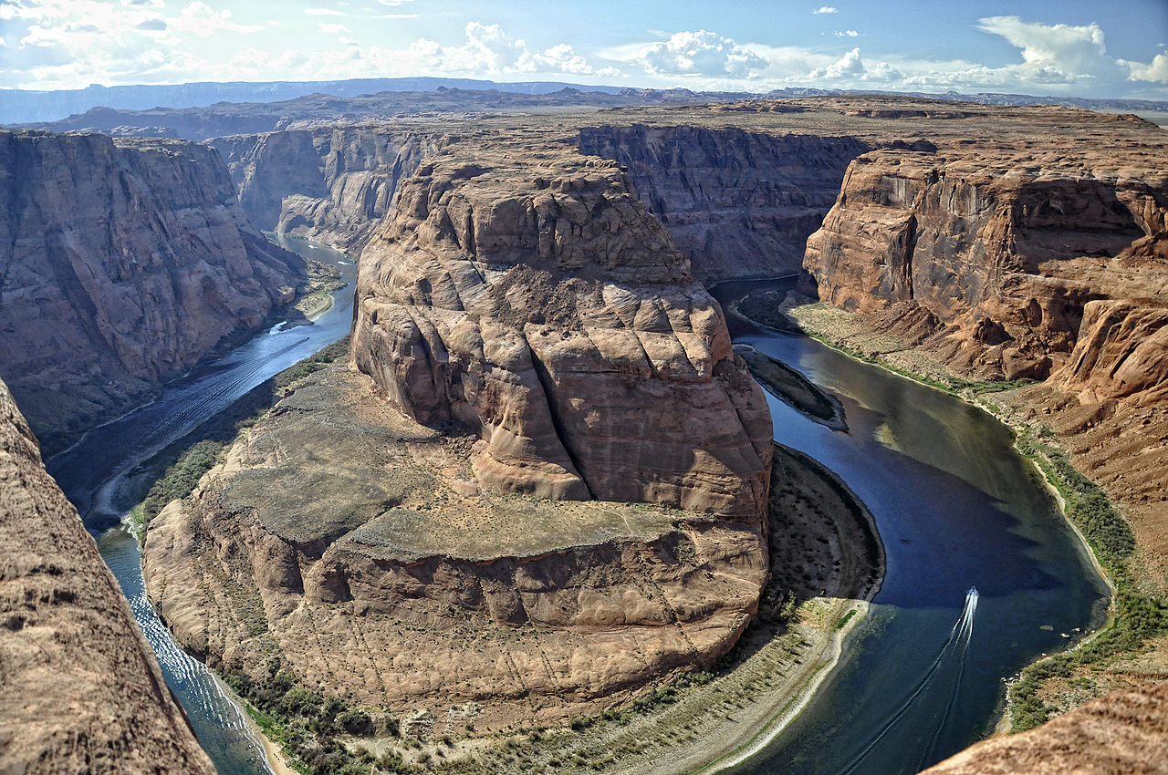 |
| Horseshoe Bend, Utah. Paul Hermans, Wikimedia |
Terrain dominated by erosion from the movement of liquid water. This is the most widespread terrain, and really almost all of Earth’s land area experiences some amount of fluvial erosion. But in this case I’m referring specifically to terrain where fluvial erosion dominates over all other types, such that topography is limited by a set of “rules” imposed by the nature of water flow and fluvial erosion.
To understand these rules, think of the experience of a single water droplet raining down somewhere on land. Presuming it’s not absorbed into the soil, the droplet will run downhill, following the steepest possible path at all points (not always the steepest overall path to the sea, but travelling down the greatest incline from its current position). Based on this simple behavior, we should be able to find a single path that a water droplet will necessarily always follow if it starts from a given point; place a water droplet at the same point on the side of a mountain twice, and it should follow the same path to the sea both times.
Now, if we place water droplets in multiple locations, they’ll each follow their own paths, but sometimes those paths will converge; if we drop water on either side of a mountain valley, we should expect the droplets to meet somewhere in the middle. And once two droplets arrive at the same point, they should follow the same path thereafter, just as two droplets starting from the same point would. So the paths of these droplets can converge, but not diverge.
If we pick any given point on the surface (that isn’t directly on a peak or ridgeline) and mark out all such paths that pass through it, we’ll find that there is some area uphill of this point covered by these paths, called a drainage basin (a.k.a. catchment area, impluvium, river basin, watershed in North America), and a single combined path leading out, called the outlet. All water that starts anywhere in the drainage basin will pass through the outlet, so the larger the drainage basin, the more water runs through the outlet (accounting for local rates of precipitation, and neglecting evaporation and groundwater flow); a small drainage basin may only produce occasional runoff, a large one will feed a raging river. Major river outlets to the sea will have the largest drainage basins of all, and often geographers will divide up landmasses into the drainage basins of these major river outlets.
Between drainage basins are divides (a.k.a. watersheds in Europe), lines across which no water flows, lying along ridgelines that are higher than the terrain on either side. The divides between large drainage basins are typically the peaks of large mountain ranges, but between smaller drainage basins they can be moderate hills or just subtly higher terrain. Mountain ranges typically have a divide running their entire length.
 |
| Asybaris01, Wikimedia |
Now, you might wonder why our water droplets can’t just all find their own paths to the sea without converging, or what happens if water reaches the bottom of a pit, and this is where erosion comes into play. As water travels across the land surface, it will tend to break down some of the surface rock or sediment and carry it along with it. The more water moves along a particular path—and the faster it moves—the more of the surface it will erode away. A lot of water following one path will carve out a channel, and the sides of the channel will be steeper than the surrounding landscape, such that any nearby water will tend to flow down into it. This both increases the amount of water moving through the channel, carving it deeper, and forms new tributary channels leading into it—which will form their own tributaries, and so on, spreading out across the landscape. This ability for a channel to carve uphill, against the direction of water flow, by changing the shape of the slopes above it is called headward erosion.
Thus, even if you begin with fairly smooth topography with
no large channels for water to follow, fluvial erosion will tend to create a
series of converging channels, such that water ultimately flows out of a small
number of outlets. Headward erosion even allows one large river to “capture”
neighboring streams: as their tributary channels extend upstream, one may breach
the divide between the river and stream, at which point the stream’s water will
start running out the deeper river channel instead of its former, shallower
outlet, turning the stream into a tributary of the river—thus further
consolidating the flow of water across the region into fewer outlet channels.
Part of the stream formerly downstream of the capture point may even switch
direction to flow into the deeper river.
 |
| Source |
But stream capture tends to work best on flat ground, and can only divert streams so far; a stream running 10 kilometers to the sea over a steady slope generally can’t be redirected 100 kilometers away to another outlet. A stream also generally can’t be made to cross a mountain range, even a very old or moderate one, as this would either require it to be running uphill at some point during its formation, or for upstream erosion to cut a channel through the mountain range that is lower than the terrain on the far side—and by the time that could happen, the range would be so eroded down as to essentially not exist anymore. There are some few exceptions where a river is older than the mountains it’s crossing and has continuously eroded down its channel as fast as the mountains have risen up; or an enclosed basin is formed such that water flow must cut through the mountains somewhere to reach the sea.
Anyway, the result is that where a major divide such as a mountain range is close to the sea, it will tend to have many small drainage basins on its seaward side; but the broader the coastal plain, the more of its area will tend to be dominated by a few large drainage basins.
 |
| Drainage divides of South America, with the Andes dividing the many small basins of the west coast from the large basins of the east coast. HydroSHEDS |
Now, if water comes to the bottom of a pit, with uphill slopes in all directions, it naturally comes to a stop and cannot flow any further. But more and more water will gather in the pit, until it overruns the the rim of the pit at its lowest point; the escaping water will begin cutting out a channel, and continue doing so until the bottom of the channel is lower than the deepest point in the pit. Thus, given time, fluvial erosion will act to eliminate such pits and enclosed basins, such that from any point on land, you should be able to reach the sea travelling only downhill.
And now let’s see how deposition figures into this: as water erodes away at rock, it breaks it into clasts, and the size of clast that can be carried depends on the speed of water flow, which itself depends on the slope of the channel the water runs down. A river running down the side of a mountain may push cobbles and pebbles along, but on reaching a flat plain it may only be able to carry fine silt. As the river passes over ever shallower terrain and slows down, clasts too heavy to carry will be deposited. To some extent this can fill up a river’s channel, but erosion is still generally stronger than deposition at the fastest-flowing part of the river, and as its channel fills a river will shift course to any lower nearby terrain, such that deposition is spread across a broader region.
So all the general principles we’ve established still hold: Rivers will form converging channels and erode out pits (or fill them in with deposited sediment) such that all points have a downhill path to the sea. But as I mentioned before, the competing forces of erosion and deposition divide fluvial terrain into source regions, with steep, fast-flowing rivers such that erosion is dominant and forms deep channels; and destination regions, with shallow, slow-flowing rivers such that deposition is dominant and forms broad plains (more formal sources will sometimes distinguish between bedrock rivers and alluvial rivers, which more-or-less line up with my source/destination categories, and some also distinguish an intermediate transport region where there is relatively little erosion or deposition). Individual channels will tend to have a curved profile from source to outlet, with progressively smaller clasts depositing along their length.
 |
| Trista L. Thornberry-Ehrlich, Colorado State University |
Hopefully you’re starting to get an emerging picture of how fluvial terrain will appear: landmasses will be split into drainage basins occupied by many tributaries feeding into a single outlet to the sea, divided by mountain ranges across which rivers usually do not cross. These mountain ranges will be cut away at their peaks by erosion, while deposition fills in valleys at their base and extends the landmass into the sea, ultimately dividing the land into rugged highlands and broad coastal plains, with a fall line where the rising surface of deposited sediment meets the falling surface of the eroding rock.
But now that we’ve built this model, it’s time to see where it fails. Everything I’ve discussed so far has been based on a few key assumptions which are mostly true across most of Earth’s surface, but not always:
First, that water raining down anywhere on land must ultimately flow back to the sea. This is generally true in areas where precipitation outruns evaporation and soil is saturated with groundwater, and it ensures that any enclosed basin will eventually fill with water until it overflows its banks and forms an outlet channel. However, in drier areas like deserts and highland plateaus, precipitation may be low enough that all water that collects within a basin ultimately evaporates away, and so the basin never completely fills with water. We’ll discuss these endorheic basins in more detail later.
Second, that all water starting at a given point must follow the same path to the sea. At broad scales this is mostly true and means that river’s can’t split, only converge into ever large rivers. But within a river itself the water obviously cannot all follow the exact same path as it has some volume (turbulent flow within rivers also adds a chaotic element to the movement of water, as opposed to the strictly predictable approach I’ve been using so far). Thus, if a river encounters some obstacle like a large rock, the water within it may diverge and follow different paths around the rock. More commonly, the water level in a river may rise above the banks of its channel and flow into a new channel; water near the bottom of the river must still move down the older, deeper channel, but water near the top of the river can flow into the new channel while still moving “downhill”. There are various cases in reality where this happens; usually it forms an anabranch, a smaller parallel stream that eventually rejoins the river (because the river usually overflows into one of its own tributaries).
But in a handful of cases, a stream splits into two distributaries which part ways and never rejoin, ultimately flowing into different outlets and sometimes even completely different oceans. For example, in Wyoming in the US at the Parting of the Waters, North Two Ocean Creek splits into two streams: one flows east into the Yellowstone River and on to the Missouri, the Mississippi, and into the Gulf of Mexico and thus the Atlantic Ocean; the other flows west into the Snake, the Columbia, and into the Pacific Ocean. Thus, the legendary Northwest Passage between the oceans does actually exist, and if you had a canoe and a strong arm you might be able to pull yourself along the centimeters-deep creek and so cross the continent without stepping onto land. Clearly this has major implications for international trade.
Pretty much all such dividing streams are similar: very small and young, or often present in dry areas with intermittent flow (the largest dividing river, in the Amazon basin, is in a flat, marshy region with frequent flooding). Water flow through the distributaries is never perfectly equally, so eventually one will cut a deeper channel than the other. This causes more water to flow through it and less through the competing distributary, and thus it forms an even deeper channel, and so on until flow through the other channel stops. Thus, these dividing streams are ultimately temporary features, and each should abandon one of their distributaries over time (hence them being common in dry regions with slow erosion and seasonal flooding). A large, mature river shouldn’t split in this fashion, though it may occasionally form small anabranches as its course shifts and it encounters obstacles or floods over its banks.
Of course, this introduces its own assumptions: that river channels and water level are relatively stable, such that new channels form rarely. Again, this is mostly true on large scales, and even on small scales in mountain streams and lowland rivers. But if channels or water levels can shift more rapidly, then anabranches may form as quickly as they’re abandoned, such that some are present at all times. This can happen due to loose soil and rapid deposition in braided rivers or tidal action and similarly rapid deposition in river deltas.
We’ll discuss both of these soon, but in short, these splits are limited in extent and neither will lead to the formation of large distributaries leading to distant outlets: for the former, channels within the river can split, but any distributaries that diverge too far from the main course of the river will eventually be abandoned in favor of shorter channels; and for the latter, the river is already so close to the sea that there’s not far the distributaries can go, and again there's a tendency to favor shorter channels in the long term.
To sum up this whole discussion, here’s a quick review of the major “rules” of fluvial terrain, and their exceptions:
- You should be able to reach the sea travelling only downhill from any point on land.
- Unless precipitation is too low to overcome evaporation, in which case endorheic basins may form.
- Rivers and streams can converge to form tributaries, but never diverge.
- Except temporarily to form anabranches and distributaries, or where rapid channel migration or water level change forms braided rivers and river deltas.
- Rivers will tend to converge into a few outlets rather than run parallel.
- But less so on steeper slopes, when close to the sea, or when divided by highlands.
- Rivers do not cross mountain ranges and highlands from one side to the other.
- Unless the river channel is older than the mountain range and has eroded down as fast as the mountains have risen, or there is an enclosed basin with no alternative outlet (and enough precipitation such that it doesn’t become an endorheic basin)
- Rivers will begin steep near their source and then flatten out as they approach the sea.
- Unless they pass through flat areas in mountain valleys or recently uplifted plateaus, in which case their profile may be more complex.
With all that established, let’s look at the landforms we might encounter in fluvial terrain, and in particular the major forms of rivers, proceeding generally downstream from source to sea. Rivers are the defining features of fluvial terrains, and may be worth including even if you’re not going to work out all the topography of your world.
Dendritic Drainage
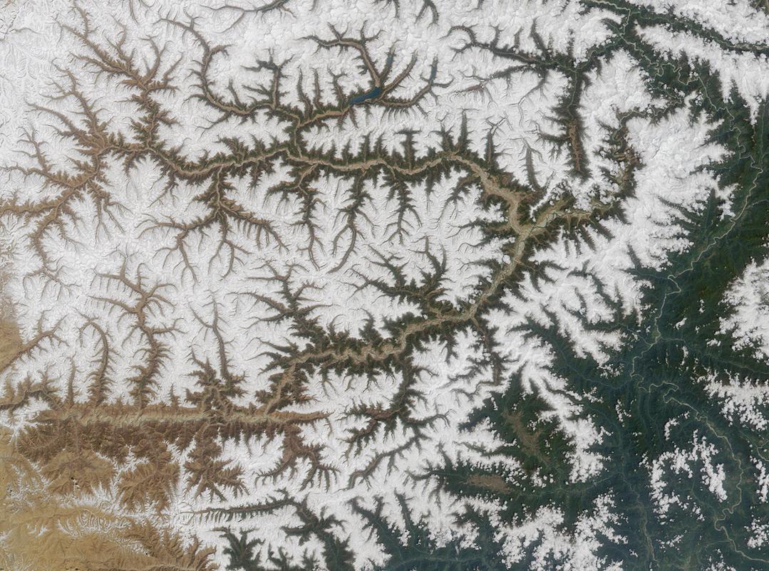 |
| Yarlung Tsangpo River, Tibet. NASA |
This is essentially the default form for rivers in source regions: stream channels converging towards each other but not simply running directly at each other, and usually with no more than 2 streams meeting at any one point, forming a structure that appears broadly similar to tree branches. This dendritic pattern results from a balance between fluvial erosion favoring shorter stream paths (as they’re steeper and so carve out deeper channels) and disfavoring sharp turns in flow direction (as this causes excessive erosion on the outer bank that will force the channel to migrate to a straighter course).
 |
| Marshall Wolff |
This same pattern will form at essentially all scales, so long as the underlying terrain is all made of roughly the same material and all erodes at the same rate. It’s even present in regions without a consistent source of water: The topography of arid regions and mountaintops still show dendritic patterns from erosion during rainfall.
However, if there is some variation in the underlying material, such that it erodes at different rates, a few other patterns can result:
- Trellis
drainage forms where there are parallel valleys or ridgelines, such as in a fold-and-thrust belt. Within each valley, streams will flow straight off the ridges and converge in a main stream running down the center; these main streams may then either cut through gaps in the ridges to converge or converge past the ends of the ridges, depending on the overall slope of the terrain (though often it's a mix of both).
- Parallel
drainage may form where there are more closely-spaced, parallel faults: streams preferentially form along the line of
easier erosion (or between lines of harder erosion) and then converge on flatter ground.

Tshf aee, Wikimedia - Rectangular
drainage is a rare variety that forms where faults have formed at right
angles to each other, such that streams follow angular paths alternating
between the two fault directions.
- Radial
drainage forms around an isolated, steep peak such as a stratovolcano, with
streams running out in all directions directly down the steep slopes. If there
is flat ground around the peak, they may then join together downstream.


V-Shaped Valley
 |
| Stillach River Valley, Germany. Kauk0r, Wikimedia |
The typical cross-section of a stream channel in a source region. As a stream erodes down a channel, the walls of the channel will collapse into the stream, due both to fluvial erosion and mass wasting; collapse of material under gravity, as the stream erodes away its support from below. That collapsing material then no longer supports the material above it, and so on, all the way up to the nearest ridgeline or peak.
The eventual result is a steep, consistent slope formed on either side of the channel. The tougher and less broken-up the material, the steeper the slopes. Even a small, intermittent stream can form a broad valley this way. The v-shaped valleys of neighboring streams will form a sharp ridgeline between them that slopes down to their junction. It doesn’t take long for any source region to be completely carved up into these valleys, so the typical topography of high mountain ranges is a maze of ridgelines and channels, with steep slopes between them.
The valley walls are not necessarily all the same gradient. For one thing, there will typically be tributary channels at many points in the valley walls. For another, certain layers of tougher, more consolidated rock will resist erosion better than the material above them, forming “shelves” that jut out from the walls. Alternating layers of weaker and tougher material can form staircase-shaped valley walls. To an extent these layers will shield those below them from erosion, but if the tough layer is particularly solid it can remain in place while the layer below is eroded deeper into the slope, forming an overhang.
Often a channel can have a shallower gradient than its banks and tributaries, so some material will be deposited in the channel and form a flat valley bottom—though usually it’s much thinner than the entire valley.
Dimensions: The angle of the slopes varies depending on the material. For loose sediment the ultimate limit is the angle of repose, which is the maximum angle at which the clasts on the surface can be supported rather than rolling down the slope. For most natural sediments on Earth this is typically 30-40° from horizontal. This is independent of clast size, and somewhat dependent on gravity but not strongly, especially within the range we expect of Earthlike planets.
As a general rule (sometimes formalized as Playfair’s Law), the depth and breadth of a stream valley in a particular area will be proportional to the size and speed of the stream, and when streams converge they will tend to do so at the same gradient.
Canyon
 |
| Santa Elena Canyon, Texas. Ann Wildermuth, NPS |
But the most striking cases are usually formed when a lowland plain is uplifted by tectonic forces, and a river erodes down to form a deep gorge in an otherwise flat-topped plateau. Laramide-type orogenies are ideal for forming canyons, as they cause this type of uplifting and also form ridgelines that help prevent the river from flowing out elsewhere, but it can occur with other forms of uplift as well. It also helps if the region is fairly arid—as this slows the rate at which the walls of this canyon are cut through with large tributaries and rounded down—and if there are alternating layers of harder and softer rock in the region, such that streams carve deep channels through the softer layers while erosion on the banks is arrested by the harder layers.
Often a preexisting river will continue to follow its path through the former lowlands and keep cutting down a deeper and deeper channel so long as no other, easier outlets become available. This is how the modern Colorado River cuts through terrain that is higher than any point on the river; were the canyon not there and a new river formed today, it could not follow the same path as this would require it to run uphill. Only the largest rivers can erode down fast enough to keep up with uplift in this way, hence why there are a few long canyons rather than whole drainage networks of canyons—at least at first.
Examples: Grand Canyon (US), Snake River Canyon (US), Fish River Canyon (Namibia), Yarlung Tsangpo Canyon (China), Three Gorges (China).
Dimensions: In strict terms, mountain canyons with tectonic causes tend to be the largest; some in the Himalayas are hundreds of kilometers long and surrounded by mountains peaking up to 6 km above the river surface, but these are not shear cliffs. The Grand Canyon, which has a less ambiguous top and bottom, has a similar length, a depth of up to 1.8 km, and varies between 1 and 29 km wide.
Impact: Canyons are obviously major barriers to travel, though occasional tributary rivers cutting into the walls can provide ramps to enter and exit them, and they can also aid travel through mountainous regions. In arid and highland regions they can effectively act as sheltered oases, much more fertile and hospitable than surrounding regions—many are forested in otherwise barren regions. Thus they can become population centers for both wildlife and civilizations, though some are also prone to flash flooding.
Badlands
 |
| Blue Gate, Utah. DanHobley, Wikimedia |
Areas where a flat plain has uplifted and begun eroding down, as in the case of canyon formation, but significant time as passed; every little stream has had time to cut a deep canyon and these have joined together, such that rather than individual canyons cutting through a broad plateau, there are now small sections of the surviving plateau—flat-topped, steep-walled mesas—surrounded by deeply eroded terrain. Again, they’re more prominent in arid regions, as heavy rain would tend to evenly erode down the plateau to create a more rounded landscape.
Examples: Badlands National Park (US), Red Deer River valley (Canada), Valle de la Luna (Argentina), Bardenas Reales (Spain).
Dimensions: Typical regions are hundreds of km2 in size. Individual mesas can be similar in size and up to 2 km above the surrounding valleys. They can also be eroded down to thin spires called hoodoos and still be as much as 100 m high.
Impact: Because these areas are necessarily arid, they’re fairly inhospitable. But sheltered canyons and river valleys can be oases of life, and the steep cliffs and mesas make good defensible positions. This is enhanced by the inhospitability; there may be few paths an invader might take, so a well-placed fort can dominate a large region.
Intermittent River
 |
| Nahal Paran, Israel. Mark A. Wilson, Wikimedia |
A river that has significant flow at some part of the year, but regularly has no water flow at all in another part, leaving a dry streambed. There are two main varieties: glacial streams fed mostly by meltwater from glaciers, such that they flow only in the warm months; and arroyos (A.K.A. wash, or wadi or oued in the arabic-speaking world, though precise definitions for all these terms varies) in arid regions that cease flowing in the dry season. Some may cease flowing only briefly, or not every year, but some ephemeral streams may flow only briefly after rainfall. Even when they cease flowing continuously, isolated lakes and ponds may remain in deeper sections of the riverbed (called gueltas in the Sahara) that may retain water even through the dry season.
In any case they still “count” as streams so far as the “rules” of fluvial erosion go, and they can carve out some fairly impressive channels given time; many canyons are formed by arroyos. But they may fill with sand in the dry season and behave more like the Eolian terrain we’ll discuss later.
Examples: Ugab River (Namibia), Sandover River (Australia). Many rivers such as the Colorado (US/Mexico) have recently become intermittent due to overuse of water in their drainage basins.
Dimensions: Usually fairly small, though the largest can be m across and run for 100s of kilometers. The inconsistent water level and loose soil often makes arroyos fairly broad and shallow when they are flowing.
Impact: When flowing, arroyos can be vital sources of water in arid regions, both for the natural ecosystem and any people in the area. Life on the shore or in the water may have adaptations to remain largely dormant through the dry season; some lungfish are able to burrow into the streambed and survive in a cocoon of mud and mucus, then reemerge when the stream returns. However, arroyos can also be prone to flash floods, if a major storm occurs upriver. Some arroyos are near-permanently dry except for occasional floods; often these are anabranches of larger rivers that occasionally overflow their banks.
Glacial streams can also flood, but overall tend to be more regular in their flow, and are less vital as water sources as they appear in cooler environments with less evaporation.
Waterfall
 |
| Niagara Falls, US/Canada. Robert F. Tobler, Wikimedia |
A waterfall forms wherever a river goes over a steep cliff, but in some cases a river can form its own cliff. If a tough layer of rock overlays a weaker layer, the water can erode deeper into the lower layer and undercut the overlaying one, eventually causing it to fall and form a cliff. As this continues, a waterfall tends to migrate upriver, which can increase the height of the cliff formed as the channel downriver of the waterfall erodes faster than that upriver. This is usually how very large waterfalls, called cataracts, form. Smaller rivers may form a deep-walled ravine if they follow a fault.
 |
| Cradel, Wikimedia |
The water at the bottom of the waterfall will tend to erode out its immediate surrounding faster than the slower-moving water downriver, so often a waterfall will have a plunge pool at its base. But if it’s a fairly small stream carrying a lot of sediment and there is flat ground at the base, then it may instead form an alluvial fan, which we’ll discuss in a moment.
Examples: Niagara Falls (US/Canada), Angel Falls (Venezuela),
Dimensions: The highest waterfall, Angel Falls, is 979 m high, but it’s fed by a fairly small river. Cataracts top out at about 100 m, but can be several kilometers wide.
Impact: Waterfalls are, of course, major barriers to boat travel along rivers. Some early river valley civilizations like the early kingdoms of Egypt had trouble extending their power beyond cataracts in the highlands. Nowadays, canal and lock networks are sometimes built to allow for riverboats to circumvent them.
Braided River
 |
| Rakaia River, New Zealand. Andrew Cooper, Wikimedia |
A broad, shallow river containing many small anabranches, somewhat resembling braided rope. Generally speaking this happens when a river’s slope suddenly decreases, often when passing from a source region to a destination region. The river slows and deposits out much of its sediment on the riverbed, such that broadens and shallows. But the sediment isn’t deposited evenly: where the river bends, the water moves faster on the bank on the outside of the curve than on the inside bank, so sediment is deposited at the inside bank while it is eroded away at the outside bank. This deepens the curve, both increasing the difference between banks and causing the whole river to move laterally relative to the overall direction of flow.
This process happens to all rivers in destination regions, but braided rivers are still flowing fast enough that erosion at the outside bank is too rapid for the river to settle into a single channel, and minor deviations quickly develop into deep curves. Deposition on the inside bank forms bars of sediment, but they’re fairly low such that a moderate rise in water level can easily overflow them and form new channels across them. Many of these channels may be abandoned once water level drops again, but if a large channel forms along a shorter path than the main existing channel, it will be be favored by water flow and eroded slightly deeper, until the old channel is abandoned.
This process plays out at different rates and scales in many different places across the river, such that at any given time the river is a tangle of channels of various sizes and sometimes there may not even be a single “main” channel clearly larger than the rest. Still, because water generally prefers to flow through the straightest path available (as it’s the steepest), there’s a limit to how far any of these anabranches can wonder from the main path of the river before they’re abandoned, such that they usually can’t diverge from it completely (if they do, it’s usually because they eroded through some obstacle to create a shorter path to the river’s outlet, and eventually the whole river will shift over to that new course). Generally these temporary “subchannels” all lie within a single broader channel lower than its surroundings. Some rivers are only seasonally braided; filling out their whole channel in the wet season, but then splitting into small subchannels on the riverbed when water level drops in the dry season.
This particular balance between high deposition on the riverbed and high erosion on the riverbanks typically requires both a high sediment supply (so, a substantial region of eroding mountains in the river’s drainage basin) and a moderate slope (low enough to allow for deposition, high enough to keep the water flow fast). An inconsistent water supply helps as well, such that the river frequently floods over bars. Thus, the ideal situation is a large river running off the foothills of a mountain range, mostly fed by seasonal meltwater from glaciers. But braided rivers are also common in arid regions where there is little vegetation to stabilize the riverbank, windblown sediment often deposits in the riverbed, and storms or wet seasons may cause occasional flooding.
Examples: Brahmaputra (India/Bangladesh), Platte (US), Tagliamento (Italy)
Dimensions: The Brahmaputra has subchannels 100-3 km wide within a larger channel 10-20 km wide, and falls 120 m over its ~850 km course. Most braided rivers are much smaller, with channels under 1 km wide and subchannels as little as 10 m, and also steeper—typically at least 16 m fall per km of river. As stated, they’re usually quite shallow; the Brahmaputra is around 30 m deep on average, and smaller rivers can be less than 1 m deep while still quite broad.
Impact: These broad, shallow rivers that deposit out large amounts of sediment can make for fairly lush wetlands. They can sometimes also make for good farmland, though their instability makes settlement and construction directly on the bank difficult, and they’re also often too shallow for regular river travel. Their breadth also makes bridges difficult to construct, though they can be relatively easy to ford. In modern times, many formerly braided rivers have been artificially confined into regular courses.
Alluvial Fan
 |
| Alluvial fan in Death Valley, California (with a road over it). Marli Miller, University of Oregon |
A depositional feature that forms when a river’s gradient very suddenly decreases, such as when a river passes directly from a steep mountain channel to a flat plain; you can think of it as the extreme case for a braided river. The sediment in the water is immediately deposited at the point of this transition and then washed out onto the surrounding landscape, forming a conical mound. The surface is covered in small braided streams, which tend to rejoin in a single river at the perimeter of the fan.
Adjacent fans along the side of a ridgeline may eventually combine to form a continuous slope of sediment called a bajada.
 |
| Death Valley, California. Modified from Dicklyon, Wikimedia |
Dimensions: Fans can be as little as a few meters wide to over 100 km, with slopes of 1-25°. They tend to be larger in arid regions, where there is little erosion.
Impact: These fans can provide a more convenient route up a steep slope or cliff, but are also prone to flash flooding.
Meandering River
 |
| Jurua River, Brazil. Alexander Gerst, Wikimedia |
The typical form of major rivers once they have reached nearly flat ground, or for some other reason the rate of erosion on the riverbanks is low. Like braided rivers they deposit more sediment than they erode away, but erode more on the outside bank where they curve while depositing more on the inside bank. But the slower-moving water erodes slower at the banks, so that the river’s lateral migration is slower and it can settle into a single channel (vegetation growth on the banks also helps slow erosion; there were likely far fewer meandering rivers and more braided rivers before land plants evolved and braided rivers are still more common in arid regions). As such, the channels are deeper and the formation of anabranches rarer.
But curves do still tend to deepen over time, such that the river loops back and forth along its course. These loops broaden over time, such that eventually two neighboring loops will breach the bar between them, forming a shortcut past the loop between them on the other side of the river. That loop will eventually be abandoned, but the deepest section on the outside edge of the curve can survive for some time as an oxbow lake, fed only by rain in its immediate surroundings, until it eventually fills in with sediment.
The transition from braided to meandering rivers isn't instantaneous though: in between are sinuous rivers that mostly follow one course and gently meander, but still tend to form many short-lived anabranches and river islands.
 |
| I couldn't find this diagram in English but I think it communicates the point well: as rivers flatten out, they'll tend to branch less and meander more. Antonov, Wikimedia |
A meandering river is usually the lowest part of a river, terminating at an estuary or river delta, but we’ll leave discussion of those to the Coastal category.
Examples: Mississippi (US), Amazon (Brazil), Yellow (China)
Dimensions: Meanders on the Mississippi River reach about 10 km from the center of the river’s course, and the river itself is 1-2 km wide—other rivers vary from under 100 m to over 10 km wide, with wider rivers tending to have less pronounced meanders relative to their size. Exactly when a river transitions from a braided river to a meandering river comes down to a complex balance of the sediment load in the river, the clast size of those sediments, and the presence of vegetation or other factors controlling erosion on the banks.
Impact: Much as with braided rivers, the sediment deposited on the banks can make for lush wetlands or fertile farmland. But the more stable banks and water level make settlement and construction easier. They are still prone to occasional flooding, though, and if anything these floods can be more hazardous for how infrequent they are and thus how unprepared the victims tend to be.
River Island
 |
| Islands in the Zambezi River, Zambia/Zimbabwe. Diego Delso, Wikimedia |
Dimensions: How large river islands get depends on how you define them; Bananal Island in Brazil is 350 km long and 55 km wide, but so vast compared to the bounding channels that you might not consider it to be an island within a river so much as a region of land between anabranches so distant they might be called separate rivers. Less ambiguous river islands are more typically 100 m to 10 km long and 1/10 as wide.
Impact: River islands tend to be favored as sites for new towns or cities as they tend to allow for easier crossing of the river, are easy to defend, and have more waterfront. Many old cities today have heavily populated river islands at their cores, and many have formed new ones by building canals.
Floodplain
 |
| Zambezi River Floodplain, Zambia. NASA |
A flat area between the banks of some rivers and moderately
steeper valley walls. In wet periods, the water level rises and the river
overflows its banks, flooding the plain. The water slows and so deposits
sediments across the plain. The largest clasts are deposited on the channel
banks, forming natural levees that
help keep the river in its channel in dry periods and reinforces the
periodicity of the flooding. Tributary streams may need to flow alongside the
river for some time before crossing a breach in the levee, in which case they
are delightfully called yazoo streams. The plain outside the levees is
generally fairly flat and level, and there may be flat terraces further up the valley walls; remnants of previous plains
when the valley was shallower. Shallow hollows in the plains may retain
standing water after flooding, forming a back swamp.
 |
| Source |
Some rivers flood every year—typically if the river’s drainage basin has a dry and wet season, or includes mountains that accumulate ice in winter and thaw in spring—sometimes regularly enough to set a calendar to. Others flood less frequently, but their meanders will usually remain within the floodplain.
Examples: Nile floodplain (Egypt), Yellow River floodplain (China), Pantanal (Brazil/Paraguay)
Dimensions: The Nile floodplain is about 20 km across over much of its course. Other flood plains can be hundreds of kilometers across. At the lower end, small streams may regularly flood an area meters from their banks, called flood-meadows.
Impact: In wet climates, floodplains may form broad wetlands; in drier areas, they can form lush areas even with no precipitation. They are among the most fertile regions on the planet, and make for excellent farmland. Most of the earliest civilizations started in flood plains, and they have remained major agricultural regions. Much of ancient Egypt’s success can be attributed to the reliability of the Nile’s floods and subsequent crop harvests. But in wetter regions the flooding can be more variable. Given that large population centers tend to form in these regions, an unusually high flood can cause catastrophic damage and death—though these floods are too infrequent and the land too productive to dissuade recolonization of the devastated areas.
Lake
 |
| Lake Tahoe, USA. Michael, Wikimedia |
A lake forms where there is an enclosed basin with a bottom lower than any point on the perimeter. The basin fills until the water level reaches the lowest point on the perimeter, where water then flows out into a new river (our “all points on land have a downhill path to the sea” rule for fluvial terrain holds here only if the path passes along the water surface, not the lakebed). This basin is typically formed by tectonic action (opening of basin by tectonic extension and subsidence or blocking of an outlet by compression and uplift) or glacial erosion (which we’ll discuss later), but small lakes can also be formed by volcanic activity, impact craters, landslides, eolian action (again, we’ll discuss it later), waterfalls (the aforementioned plunge pools), fluvial deposition of sediment (formation of oxbow lakes, formation of levees in floodplains), deposition of sediment along coasts by wave or tide action (again, later), biological activity (beaver dams, peat deposition, coral formation), or human activity (damming rivers to make reservoirs or excavating out quarries and then abandoning them).
As mentioned, the lake will fill with sediment and the outlet channel will erode down, so all lakes will eventually either be filled in or drain out their lowering outlet. But this can take thousands or even millions of years, especially if there is continued tectonism, the lake is fed by a small or arid drainage basin, or the lake is partircularly large. Filling of lakes with sediment can make flat, fertile plains in highland regions, and for a time these may still occasionally flood in wet periods.
Young mountain ranges tend to form many lakes, especially in interior plateaus. Flat, tectonically inactive plains rarely form large lakes, except after the retreat of major glaciers. And as we’ll see, more arid regions can form more enduring lakes within endorheic basins.
Many simple map generators will depict lakes only where the land surface is below sea level, but in truth lakes may form kilometers higher, and a fair portion of them do not reach below sea level even at their deepest point, such that they wouldn’t appear on such maps at all. Some people will try to draw their own lakes on such maps, but a common error is to draw them such that the elevation of their shores vary, which shouldn’t be possible for a flat lake surface. On the other hand, some lakes within endorheic basins may have surfaces below sea level, but we’ll discuss those later.
The general appearance of lakes varies, of course, but notably artificial reservoirs often have very jagged coastlines because they formed only recently and their coastlines lie along existing topography; some lakes at high latitudes appear similar due to continuously changing water level after the recent retreat of large glaciers. But more mature lakes will often have more rounded coastlines due to erosion and deposition along their shores.
Examples: Lake Superior (US/Canada), Lake Baikal (Russia), Lake Tanganyika (Southeast Africa).
Dimensions: The Caspian Sea is over 370,000 km2 and 1200 km long, but is not so much a lake that formed on the continents as a small section of ocean that has been trapped between pieces of continent during the assembly of Eurasia. Lake Superior is the largest freshwater lake by area, at over 82,000 km2 and about 600 km long, but is caused primarly by glacial erosion. The largest freshwater lake by area formed on land by primarily nonglacial forces is Lake Tanganyika, at over 32,000 km2 and 670 km long. Otherwise lakes come in all shapes and sizes, with relatively few over 300 km long or 5,000 km2 in area. Lake Baikal reaches to 1,627 m depth, but most lakes are under 100 m deep.
Impact: Lakes tend to have calmer, slower-moving water than rivers, so may make better environments for plant life, slow-swimming or young animals, or small boats and rafts. They can also make for convenient water sources, especially in arid regions where arroyos may run dry but lakes may be more persistent—though in such cases, lake level may vary considerably with the seasons, making plant growth and permanent settlement on the banks difficult.
Large lakes, however, can develop large waves or currents, and may even develop their own weather systems. A particular large lake can be treated in some ways as a small sea, inhabited by large marine animals, supporting large fishing communities or crossed with significant watercraft, and in some cases hosting major naval battles.
Wetlands
 |
| Warta Mouth National Park, Poland. A. Savin, Wikimedia |
Areas that typically have standing or slow-moving water, forming unique ecosystems. Marshes and swamps occur on the banks of meandering rivers and lakes; marshes are the shallow water regions that grow reeds and other low plants, and swamps are the adjoining flat areas that are above water but still fairly wet and may occasionally flood, and grow larger trees and undergrowth.
 |
| USGS |
Examples: Everglades (US), Mesopotamian Marshes (Iraq), Vasyugan Swamp (Russia)
Dimensions: Anywhere from small pockets on the bank of a stream to hundreds of thousands of km2 in a major river floodplain.
Impact: Wetlands can support a large diversity of wildlife species. Often animals from neighboring ecosystems spend a childhood stage in marshes or swamps, sheltered from large predators. Their suitability as farmland varies; some can be quite fertile, but others may be too salty or acidic. But even in the former case, clearing them for the first time can be a challenge, and cause significant ecological damage, as well as destabilize rivers and lead to flooding. The peat from bogs and fens has also been an important heating fuel through much of history for cold regions, and they also produce other resources like bog iron.
Wetlands are also notoriously difficult to traverse. A relatively small river can become a more significant barrier through the wetlands it produces, and so paths through these wetlands can be strategic chokepoints.
Karst
 |
| Ha Long Bay, Vietnam. Thomas Hirsch, Wikimedia |
A type of terrain that can form where the bedrock is easily-eroded limestone—formed in warm, shallow marine environments—or a similar material. Rather than eroding down evenly from the surface, these areas tend to erode much more quickly at faults and cracks in the rock and so form complex surfaces and underground cave systems. Rivers may disappear into a cave and then reappear elsewhere downhill as a spring, sometimes several times. As such our “rule” that there must be a downhill path to the sea from all points still sort of holds, but the path may sometimes pass underground, which won’t be clear from a topographic map.
 |
| Common karst features. USGS |
The bare limestone often has a distinctive “knobby” appearance, becoming more jagged as it is more deeply eroded. Where they don’t disappear into caves, rivers may cut deep gorges (called calanques in the Mediterranean). After most of the limestone is eroded away, isolated towers of limestone can remain with steep cliffs; much like the succession of canyons to badlands in uplifted plains (both are caused by uneven erosion, but in karst regions it’s more fundamentally tied to the properties of the rock, so these structures can form in much wetter climates). In the most dramatic cases, this creates a terrain covered in tall, sharp blades or pillars of rock. But in most karst regions the limestone is at least partially buried in sediment, such that only outcrops are visible; making for still hilly and irregular but not ludicrously impassable terrain.
Though karst can appear essentially anywhere (the limestone need not have been deposited recently), the most exposed and dramatic examples tend to appear in warm, wet climates with heavier erosion. Some amount of recent uplift is also necessary for the limestone to have been exposed at the surface but not yet totally eroded away or buried.
Examples: South China Karst, Ha Long Bay (Vietnam), Tsingy de Bemaraha (Madagascar), Massif Central (France)
Dimensions: Definitions vary, but roughly 15% of Earth’s land surface is some variety of karst terrain—though again, most of this has only outcroppings of bare limestone. Where they do appear, uncovered limestone pillars can be up to hundreds of meters tall, even while only a fraction as wide at their base and with near-vertical sides.
Impact: Like badlands regions, karst areas are ideal for defense against invading forces. Heavily eroded karst can be difficult and hazardous to traverse, to the point of restricting travel. And of course, river travel can be difficult if rivers occasionally disappear underground.
Cave
.jpg) |
| Skocjan Caves, Slovenia. Peretz Partensky, Wikimedia |
I’ve already discussed lava tubes in the past, and volcanic magma chambers can also form caves once they go extinct, but most caves today form in karst regions, as water running underground dissolves the surrounding limestone. Caves can also form by dissolution of other minerals (evaporites like salt and gypsum especially), wave and tidal erosion along coastlines, or opening of gaps in tectonic faults.
Some caves can have large openings to the surface, and others can be completely isolated. Because they often form—or are expanded by—erosion along underground streams, they often have complex branching patterns, and large chambers may occasionally be connected by tiny passageways. Slow erosion and deposition of minerals within caves can form a variety of unique structures like stalactites and stalagmites, especially in karst caves.
Examples: Mammoth Cave (US), Clearwater Cave System (Malaysia), Son Doong Cave (Vietnam)
Dimensions: The largest cave systems contain 100s of km of passages and can reach km deep, though each passage is no more thans 100s of m across. The longest known completely underground room in a cave (Sarawak Chamber) is 700 m long, but open-ended passages near the surface can run for kilometers.
Much as with lava tubes, there is likely to be some inverse relationship between cave size and surface gravity, as the ultimate limit on the maximum size of caves is the ability for the walls to support the ceiling against the pressure of overlying rock. This also means, incidentally, that the maximum size of a cave decreases with depth, and we’re unlikely to find any in the lower crust or mantle.
Impact: Caves provide shelter from the elements, and so any reasonably accessible cave will tend to be inhabited by animals, including early humans. The caves will also tend to preserve anything left inside them, hence the many pieces of ancient artifacts, artwork, or remains found in caves. More recently, they have continued to serve as temporary shelter, secret hideaways, or makeshift homes. Cave exploration has become something of sport in recent years, with teams exploring deep into thin passageways, though personally I can think of few things I wouldn’t rather experience.
Caves isolated from the surface can occasionally form isolated ecosystems, usually supported by chemotrophic microbes and including various animal species adapted for life without access to light.
Glacial
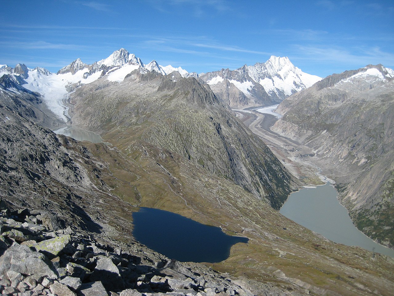 |
| Aare Glaciers, Switzerland. Markus Bernet, Wikimedia |
Terrain dominated by the action of large masses of ice, either currently or in the geologically recent past. This, of course, requires that glaciers will be present, which isn’t a given for Earthlike worlds, and many of the features we’ll discuss here result from the recent retreat of major glaciers, and so might be expected on a world in the warm stage of an ice age cycling between warmer and cooler states—i.e., worlds like Earth today. If your world is not in an ice age, it will simply lack many of these features, though it may still have some mountain glaciers.
Glaciers are masses of ice so large (roughly 50 meters deep at least, probably scaling inversely with gravity on other worlds) that the ice near the base is continuously deformed by the pressure, and the whole mass begins to flow outwards like a very viscous fluid—though, much like the mantle, it’s still mostly solid throughout. If it’s not too cold, the pressure at the glacier’s base may form a thin layer of water that allows the glacier to slide along much faster, but even without this the glacier will continue to flow through deformation of the solid ice alone.
The position and extent of a glacier isn’t merely a matter of temperature: it’s largely a balance between the addition of ice, mostly by snowfall in winter, and loss of ice, mostly by melting in summer, but also by calving of icebergs where a glacier meets the sea. Obviously the colder it is, the less a glacier will melt, and it also has to remain below freezing for snow to fall, but the region with the greatest overall snowfall compared to melting may be far from the coldest region of the planet, and so major glaciers may form far from the poles; the Laurentide Ice Sheet that covered much of North America 20,000 years ago probably first formed in Quebec or Labrador.
A large glacier can then extend out into regions that receive little snow and remain above-freezing year-round, so long as the influx of ice from the colder parts of the glacier matches melting at the glacier surface. As this balance shifts—both across the seasons and over long periods of time as climate shifts—the edge of the glacier will advance or retreat. But even when a glacier retreats, the ice within a glacier is still flowing outwards, towards the edges; it’s just that melting outpaces the flow of ice.
As the glacier advances, material eroded off the terrain below or falling on top of the glacier will be carried within it, and often pushed towards the end by the internal flow of ice (breaking down further in the process). As the glacier retreats, this material deposits out as glacial till: a mix of clasts of different sizes, from fine silt up to large boulders, often of various different rocks and minerals, with no internal sorting or layering—in contrast to the typically orderly deposits formed by purely fluvial erosion.
One common consequence of the advance and retreat of large glaciers is isostatic rebound. The weight of a large glacier can push down the land surface by as much as hundreds of meters; after the glacier retreats, the land gradually rises back up. In some areas of northern Europe and North America, the land is still rising after the retreat of the last glaciers, by as much as 2 centimers a year. This initial decline and then rise in terrain can pretty significantly shift drainage patterns over the region.
 |
| Topography of Antarctica under the ice today (left) and a reconstruction of its topography after isostatic rebound (right). Paxman et al. 2019 |
We’ll discuss the major types of glaciers first, and then the landforms they create; most of these are, again, left in the wake of retreating glaciers, so the degree to which they’re present on your world will depend on its climatological history.
Mountain Glacier
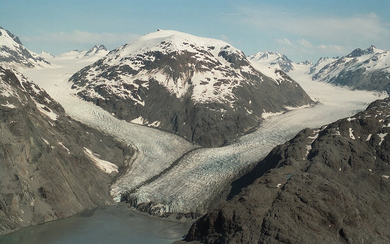 |
| Morse and Muir Glaciers, Alaska. LCGS Russ, Wikimedia |
A.K.A. Alpine glacier. The most common type of glacier, forming within river and stream valleys in high mountains. Much as with rivers, they’ll flow downhill through channels, converge to join into larger glaciers, and generally follow all the same “rules” for rivers we established in the last section. If they terminate before reaching the sea, the meltwater they produce will typically form a stream; many major rivers are largely fed by glacial meltwater.
 |
| Common glacial features. Kelvinsong, Wikimedia |
Though they often appear mostly white, large amounts of debris falling off the adjacent mountains may gather on top or be pulled into the glacier. As the glacier melts, this till will become concentrated within the ice, staining it black or brown. A glacier that has melted nearly completely may leave behind a rock glacier, now mostly composed of rock and sediment gathered around an icy core that still flows downhill.
 |
| Chugach Mountains, Alaska. USGS |
As most glaciers have retreated since their maximum extent thousands of years ago, those that don’t reach the sea mostly terminate within the valleys they themselves have carved out, forming sloping cliffs of rock between the valley walls, with meltwater forming either a lake or a stream (the latter often running out a tunnel in the ice that extends under the glacier a short distance). But a few Piedmont glaciers extend out from the mountains into flatter ground and spread out into a sloped fan of ice.
.jpg/1024px-Bylot_Island_Glacier_(cropped).jpg) |
| Bylot Island, Canada. Mike Beauregard, Wikimedia |
Examples: Aletsch Glacier (Switzerland), Endeavor Piedmont Glacier (Antarctica), Eel Glacier (US), Fedchenko Glacier (Tajikistan)
Dimensions: Typically 100s of m deep and similarly wide, and km long. The longest glaciers outside the polar regions run around 70 km long, and they can run to several km deep.
Impact: Though flat on top, traversing a glacier can be quite dangerous, as they’re often cut through with crevasses reaching deep into the glacier that may be concealed under snow or debris. Continuous flow of the ice also makes permanent construction largely impossible.
Continental Glacier
 |
| Greenland. Hannes Grobe, Wikimedia |
A.K.A. Ice sheet. Large glaciers up to kilometers deep, covering large portions of major landmasses. These spread outward in all directions from the deepest point at their center, largely ignoring topography and simply flowing over any but the tallest mountains. Though if the glacier does meet a high mountain range near its edges, it may divide into many mountain glaciers passing between the highest peaks (and possibly merge on the other side, like a stream passing through a grate).
Major glaciers spread across much of North America and Eurasia in the glacial periods of our current ice ages, and many of the unique features of those regions is a result of their erosion.
 |
| Major glaciers in the northern hemisphere during the last glacial maximum. Hannes Grobe, Wikimedia |
The majority of Earth’s fresh water is locked in these glaciers. Were they to melt completely, sea level would rise by about 70 meters, though even in the worst climate change scenarios this would probably take thousands of years. 20,000 years ago, in the depths of the most recent glacial period, sea level was about 120 meters lower than today.
Only two ice sheets greater than 50,000 km2 in area remain on Earth today, in Antarctica and Greenland, both covering essentially their entire landmass (for now). But various smaller ice caps (with high central domes above the surrounding terrain) and icefields (lower than their confining mountains but still deep, contiguous, and flowing out in all directions) exist as well. They behave in many ways like ice sheets, though are generally confined within mountains and extend past them only in individual tongues that behave as mountain glaciers (called outlet glaciers).
 |
| NASA |
Mars also has a pair of polar ice sheets (and various smaller glaciers), which are in many ways similar to Earth’s, but because they are far older and receive little precipitation, they have some different features; in particular, patterns of spiraling grooves formed by gradual erosion and deposition of soil by winds over millions of years.
Examples: Antarctic Ice Sheet; Greenland Ice Sheet. Vatnajökull (Iceland) is a notable ice cap, and the Southern Patagonian Icefield (Chile/Argentina) a notable icefield.
Dimensions: The Antarctic Ice Sheet covers 14 million km2 and reaches to over 4 km deep. Even larger glaciers cover the northern continents during glacial periods. These glaciers typically have parabolic slopes: close to flat near the center, then gradually curving down to their fairly steep edges, which may be shear cliffs of ice. But the exact shape can be fairly complex due to varying rates of ice flow across different types of underlying terrain.
Impact: Continental Glaciers are not completely lifeless—some microbes can survive in the ice, and emperor penguins famously overwinter on the Antarctic Ice Sheet—but they are significantly less hospitable than even the coldest tundras. Aside from a few small science stations on more stable sections of the ice, they are also largely uninhabited by humans. Though they play an important role in balancing the climate and we certainly shouldn’t be happy to see them go, they’re about the most desolate and inhospitable regions of the Earth’s surface.
Ice Shelf
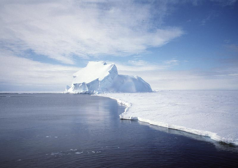 |
| Riiser-Larsen Ice Shelf, Antarctica. NASA |
A large expanse of ice floating on water, formed where a glacier encounters the sea. A deep glacier may still run along the land surface even when it is below sea level, because it is too heavy to be supported by the shallow coastal waters—this is the case across much of Antarctica. But eventually the glacier will run into deep-enough water that it can float. Without firm support at its base, the glacier thins out and becomes much flatter.
Icebergs will calve off the edges of the shelf, often leaving sheer cliffs at the edges, especially in summer. Thinner pack ice may gather along the edge of the ice shelf, forming a lower surface that amphibious animals can climb on to.
Dimensions: The Antarctic ice shelves total over 1.5 million km2 in area, and grow considerably in winter (for now). The permanent regions of ice are generally 100 m to 1 km thick; notably far thicker than sea ice that forms on its own in the open ocean, which is rarely more than a few meters thick.
Impact: Though the surfaces of these shelfs are similarly inhospitable to ice sheets, marine life can flourish in the shallow waters at the edge of the ice shelf. Various animals have adapted to swim and hunt in these waters and then climb onto the ice to rest or escape predators.
U-Shaped Valley
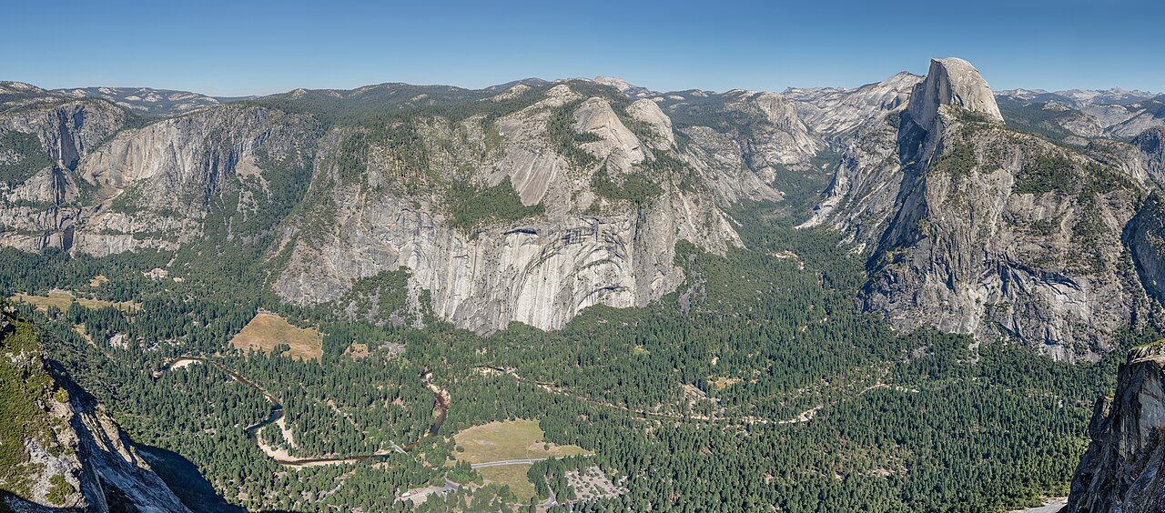 |
| Yosemite Valley, California. Tuxyso, Wikimedia |
A.K.A. Trough valley. The typical result of erosion by mountain glaciers. The glacier itself occupies far more space than a river stream typically does, often approaching the peaks of the surrounding mountains, so rather than digging a thin, deep channel, it carves out the whole valley floor. After the glacier retreats, the remaining valley tends to have a much broader, flatter floor than usual v-shaped valleys, bounded by very steep, sometimes near-vertical valley walls. A small stream will typically run through the center, often called a misfit stream as it’s far smaller than what would usually be expected for such a large valley.
 |
| Cecilia Bernal, Wikimedia |
There are numerous specific features formed by U-shaped valleys, many with their own fancy French names, so let’s run through them quickly:
- Arête:
The sharp ridgeline between neighboring U-shaped valleys, with even steeper
slopes than those between v-shaped valleys.
.jpg/640px-Schaefler_to_Saentis_(_West).jpg)
Alpstein, Switzerland. Caumasee, Wikimedia - Cirque:
A basin scooped out of the side of a mountain formed at the head of a glacier
(the term may also refer to a small glacier on a slope that scoops out such a
basin). If the glacier reaches to flatter ground, the descending ice will often
erode out a depression there before proceeding into a U-shaped valley, such
that after the glacier melts a lake will form at the cirque’s base, called a tarn.
DooFi, Wikimedia - Glacial
Horn: A particular steep mountain peak formed where three or more cirques
form around the peak of a single mountain.

Alpamayo, Peru. Frank R 1981, Wikimedia - Col:
A broad term for the lowest point on a ridgeline between two peaks, but glacial
circues in particular tend to cut low cols between them when forming close
together on either side of an arête.
- Hanging Valley: A junction between
U-shaped valleys with floors at different elevations, such that there is a
steep cliff between them. This is formed where a tributary glacier joins a
larger glacier; so long as the tops of the glaciers are at similar levels,
there’s no strong tendency for them to erode their bases to similar levels.
There will often be a waterfall here from a misfit stream.

Bridalveil Fall, California. Mav, Wikimedia

Dimensions: Naturally, about as big as mountain glaciers, though they can be longer if formed by the longer glaciers that existed in the past; 100s of m to km wide with similarly tall walls, and up to 100s of km long.
Impact: The flat valley floor can make for good farmland or pasture in otherwise cold regions, and also make U-shaped valleys rather easier to move through than v-shaped valleys; but the dividing arêtes can make travel between valleys difficult, such that communities in these valleys may be fairly isolated and have better communication with distant regions in the same valley than with closer regions across ridgelines. Older valleys or those in lower terrain may have much gentler walls that don’t inhibit travel as much, but the valley floor will still generally be easier for travel and settlement.
If the glacier is still present upvalley, there is some risk that it will advance again and overrun any settlements in the valley. Alternatively, a hot summer may cause flash flooding, or a warming climate may melt the glacier completely and deny the valley its regular source of water.
Fjord
.jpg/1280px-Geiranger_Fjord_(7793986108).jpg) |
| Geiranger Fjord, Norway. Vladislov Bezrukov, Wikimedia |
A long inlet formed along mountainous coasts where a glacier has carved a U-shaped valley all the way out the sea, and then later warming of the climate has caused the glacier to retreat and sea level to rise and flood into the valley. The shores of the fjord will be steep along most of the fjord’s length, but at the end of the fjord the flat valley floor will form a shallow beach.
Examine the mountains along the west coast of the Americas, and you can see a gradual transition from typical mountain coasts with forearc basins, to mountains directly abutting the coast with occasional lone fjords, to coastal archipelagos of mountainous islands separated by intersecting fjords (the sea has flooded over the cols between neighboring valleys).
In some cases a glacier may carve out a deep valley floor, but with high ground remaining between it and the sea; in this case a finger lake may form, broadly similar to a fjord but not directly connected to the sea, instead draining out into a thin river at one end. Sometimes there may be a fjord and finger lake(s) in the same valley.
Examples: Sognefjord (Norway), Scoresby Sound (Greenland), Saguenay Fjord (Canada). The Finger Lakes (US) are prominent, well, finger lakes.
Dimension: Again, as big as glacial valleys, with waters sometimes over a km deep.
Impact: Again, the valley above the fjord can make for good farming, and the fjord itself can make for good fishing; the sheltered waters are ideal breeding grounds. A coastal town at the end of a fjord can take advantage of both resources. Because of the high ridgelines and steep coasts closer to the sea, travel between neighboring fjords requires either a long detour inland or travel by boat, so it’s perhaps no surprise that the inhabitants of Norway developped a maritime culture.
Moraine
 |
| Lateral moraine of Miage Glacier, Italy. Yves Lemarcheix, Wikimedia |
Long mounds of eroded material gathered along the edges of a glacier. Terminal moraines are pushed along the forward “tongue” of the glacier, lateral moraines gather along the edges of a mountain glacier, and where two mountain glaciers meet their lateral moraines may join into a medial moraine between them.
When a glacier retreats, the material remains and forms a mound of glacial till on the ground (which is still called a “moraine”). A lake often forms from meltwater gathering behind the terminal moraine. A retreating mountain glacier may leave many moraines in its wake during brief episodes of advance, forming a series of lakes, called paternoster lakes, connected by a single stream (this can also form finger lakes in valleys with shallower gradients).
 |
| Seven Rila Lakes, Bulgaria. Ivelin Minkov, Wikimedia |
Examples: Oak Ridges Moraine (Canada), Cape Cod (US); Long Island (US) is formed of two terminal moraines.
Dimensions: The largest moraines left by continental glaciers can stretch 1,000s of km and pile up 100s of m high, though if they’ve had any significant time to erode they’ll tend to have fairly shallow slopes. Moraines in mountains are more typicall 10s of m high at most, and soon erode down to very moderate hills.
Impact: These generally aren’t high or steep enough to impede travel, and are notable mostly just for the way they shape hydrology, forming lakes or dividing drainage basins. If a large moraine forms near the coast and sea level later rises, it may form a string of peninsulas, islands, and shallow banks, as can be seen in the US northeast.
Outwash Plain
 |
| Skeiðarársandur, Iceland. TommyBee, Wikimedia |
A.K.A. sandur. The region directly in front of a glacier, dominated by the flow of meltwater off the glacier. These streams will carry a good bit of glacial till, so often form braided streams and alluvial fans (technically “outwash fans”, as they contain unsorted till rather than the fine sediment of alluvial fans). Moraines and other deposits will form lakes here and there across the landscape. If the glacier is still nearby, cold air descending its slope will blow out across the plain as cold katabatic winds. These winds can carry dust 100s or even 1,000s of km from the glacier and deposit it as fine layers of fine, packed sediment called loess.
 |
| Hans Hillewaert, Wikimedia |
As these plains often form on terrain the glacier has passed over, they’ll typically be fairly flat, with any protruding features rounded down by glacial erosion. There are numerous named landforms often left behind by retreating glaciers in their outwash plains, many of which may still be present long after the glacier’s retreat, so to save some time I’ll just review them here:
- Esker: A long, snaking mound of till, formed
by a meltwater stream running through a tunnel at the base of the glacier;
after the glacier retreats, the stream shifts to lower ground, but the till it had
deposited within the tunnel remains.
Fulufjället National Park, Sweden. Hanna Lokrantz, Wikimedia - Kame: An irregular hill, formed when till
gathers within a pit on top of a melting glacier and then deposits as the
glacier melts completely.

Dude Hill, Wyoming. Jo Suderman, NPS - Kettle Lake: A roundish, deep lake,
formed when a block of ice breaks from the glacier, settles into the ground,
and then later melts. The ice may be covered in sediment (forming a mound
called a pingo) and take thousands of years to melt, such that a mound
gradually subsides into a lake.

Isunngua, Greenland. Algkalv, Wikimedia - Drumlin: A tadpole-shaped mound with the
“tail” pointing in the direction of glacial flow. Exactly how they form is a
matter of debate, but it’s generally believed to be due to deposition of till beneath
a glacier (either deposited from meltwater, like an esker, or dragged along by
the ice) into a mound that is then carved into shape by further glacier flow.
Source - Roche
Moutonnée: A hill of bedrock with a smooth slope on one side, facing into
the direction of glacial flow, and a steep slope on the other side. The flow of
the glacier across the surface eroded out the smooth side, while plucking,
formation of ice within vertical fractures in the rock, pulled chunks of rock
away from the steep side.
Chabacano, Wikimedia - Crag
and Tail: A hill with exposed bedrock like a roche moutonnée (the crag),
but a long tail of sediment like a drumlin; in this case the rock was embedded
in sediment, and the glacier eroded away the sediment from one side, but the
tougher bedrock sheltered the sediment on its lee side.

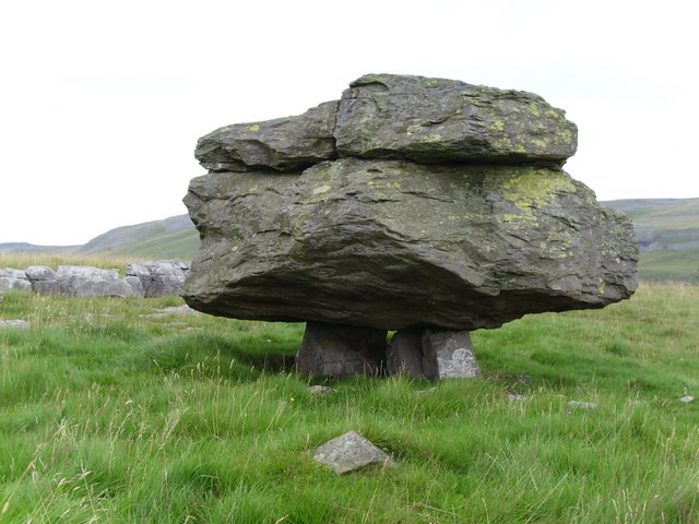
Binny Craig, Scotland. paul birrell, Wikimedia - Erratic:
A large boulder standing on the ground, with no nearby exposed bedrock it may
have broken off from. These were carried within the glacier, and then deposited
when they melted.
Yorkshire, England. Gordon Hatton, Wikimedia


Examples: Hummocky terrain can be seen most prominently in Canada and Finland, and young outwash plains are present in many areas of Iceland.
Dimensions: Former outwash plains stretch for millions of km2. Individual eskers and kames are typically 1s to 10s of m high, drumlins and eroded hills generally a bit larger, up to over a km. Kettle lakes can be m to km across, and even larger lakes may form in the irregular basins formed.
Impact: Young outwash plains are fairly barren, especially when formed in the wake of glacial retreat; the soil has been stripped away, the unsorted glacial till is a poor substitute for plants or agriculture, and the cold katabatic winds don’t help matters. Broad, shifting rivers make travel and settlement difficult. They also just look fairly foreboding; if you’ve ever seen a movie or TV show with sweeping aerial shots of an “alien” planet with a barren, dark landscape crisscrossed with rivers stained various colors by mud, you’re probably looking at outwash plains in Iceland.
Prospects improve as the glacier continues to retreat and the outwash plains age. Fluvial erosion will help sort the sediment and beat the terrain into a somewhat saner topography with more stable river channels, and the loess deposited by winds can make for good farmland.
Glacial Lake
As we’ve seen, glaciers will form quite a few lakes as they retreat. In addition to various small kettle lakes and lakes trapped behind moraines, they can also form large bodies of water like the American Great Lakes, where they’ve reshaped the terrain of much of the continent’s interior without regard to the typical “rules” of fluvial erosion, such that large basins are left in their wake. Even larger lakes like Lake Agassiz can form on a coastal plain when a continental glacier blocks access to the sea, such that water gathers between the glacier and the higher interior.
_use_fileTeller_and_Leverington%2C_2004.jpg/976px-7%2C900_Glacial_Lake_Agassiz_%26_Glacial_Lake_Ojibway_(7900)_use_fileTeller_and_Leverington%2C_2004.jpg) |
| Glacial lakes in Canada 7,900 years ago. Chris Light, Wikimedia |
But as a glacier retreats, lakes can also form on the glacier itself, or between the glacier and another obstacle like a mountain range. Huge volumes of meltwater can gather behind a dam of that is gradually melting away. When the dam inevitably fails, it’s likely to break at its base, where the pressure is greatest, such that the whole lake flows out . Such floods, called jökulhlaups (the term also includes flooding caused by the outburst of meltwater from under a glacier due to volcanic activity), occasionally occur today, flooding the areas downstream and often tearing up much of the terrain and then depositing it in alluvial fans or forming broad networks of channels and bars like an immense braided river (in this case the braiding is due not so much to the long-term evolution of the river as the fact that with so much water and no exisitng large channels, the water simply flows out any way it can and rapidly digs down channels wherever it does).
But during the retreat of large continental glaciers, the lakes can be hundreds of km across and the ice dams km high. The resulting jökulhlaups would have been catastrophic events sweeping over huge regions, creating the scablands still present in some mountainous regions today; showing much of the same rapid erosion and deposition as for smaller floods, but at much larger scales, digging braided channels up to 100 m deep. Ripple marks—parallel ridges often found in the sediment on riverbeds perpendicular to the direction of water flow, typically centimers high—can form up to 20 m high.
 |
| Giant ripple marks along the Columbia River, Washington. brewbooks, Wikimedia |
Dimensions: Up to 100s of km across and km deep.
Impact: As the glaciers retreated, there may have been some cases where lake shores significantly shifted over the course of single lifetimes, which may have caused some inconvenience for life or settlements there, even when it didn’t happen catastrophically. Nowadays, there are a number of remaining dry lakebeds or odd drainage patterns left behind by these lakes.
Jökulhlaups are a hazard in coastal regions of Iceland downsteam of glaciers sitting on active volcanoes, though these days it’s generally fairly easy to predict which areas are at risk during an eruption. It’s not clear if anyone was around to witness the massive jökulhlaups of the retreating glaciers across North America and Eurasia, but it’s easy to imagine how cataclysmic such an event may be for any society that found itself in one’s path.
The scablands left behind by large jökulhlaups are in many ways similar to the badlands we’ve already discussed, and indeed easily confused with them.
Eolian
 |
| Sossusvlei, Namibia. Ikiwaner, Wikimedia |
Terrain dominated by the action of wind. This happens not where there is a particular excess of wind, but where there is a particular lack of water that could create fluvial or glacial terrain. Hence, this terrain occurs most commonly in deserts—and I’ll also discuss a few other features here unique to arid regions that aren’t all necessarily formed by wind (to be honest I just took the opportunity to say “eolian” more).
Air is still a fluid, and so in many cases eolian and fluvial behave in similar ways and can produce similar landforms. But air is not bound to descend downhill along the land surface to the sea, and does not gather in pits, so the “rules” of fluvial erosion we discussed earlier no longer apply.
That said, no region of Earth is completely dry (though some Antarctic dry valleys come close) so fluvial erosion is often still at play to some extent. In semiarid regions it’s generally still strong enough to dig out channels and break through the edges of enclosed basins, but eolian forces may still erode away outcrops and move sediment in ways that can shift the course of streams. In the most arid deserts, fluvial erosion is near absent and the terrain is shaped mostly be eolian forces (along with other nonfluvial processes like mass wasting). But many regions are in between, with the underlying rock and compacted sediment carved into stream channels by intermittent rains or floods, but a more mobile layer of soil above that shaped by wind.
Endorheic Basin
 |
| Üüreg Lake, Mongolia. NASA |
An enclosed basins where every part of the rim is higher than its lowest point (measuring terrain along the tops of rivers or lakes, not their beds, so a deep lake with a shallow outlet doesn’t count) such that there is no path for water to flow out of the basin. These form for much the same reasons as we previously discussed for lakes: Tectonic, glacial, or other forces may either block the outlet for a drainage basin or cause the interior of the basin to subside such that it is lower than its outlet. The difference here is that, while a lake may form, it never accumulates enough water to rise to the lowest point of a basin’s rim, and so cannot drain out into the sea.
Presuming there is at least occasional precipitation of some form within the basin, this is only possible if the rate of evaporation within the basin matches the rate of precipitation, such that water cannot accumulate (seepage of water through soil can generally only account for very small, dry basins, and basins where water flows out through an underground outlet may appear like endorheic basins on a map, but are generally not considered as such and instead called cryptorheic basins). This is most often the case in hot, arid climates, but by no means are endorheic basins restricted to deserts. The formation conditions are a balance between:
- temperature (higher temperature drives more evaporation)
- depth of the basin (deeper basins require more water to fill)
on the one hand, and:
- precipitation rate across the whole basin
- size of the basin (larger basins gather more water)
- age of the basin (older basins have more opportunities to overflow or erode through their rim)
on the other. Small, short-lived basins can form even in rainforests (e.g. when an oxbow lake forms), longer-lived basins may form in mountains even in wet conditions, and larger, shallower basins are mostly restriced to arid climates. The largest endorheic basins tend to form in semiarid regions where there is still enough rain such that fluvial erosion carves channels between neighboring basins, but not quite enough to flood the whole basin. But aside from a few prominent examples of such basins, most large endorheic basins are in deserts or dry highland plateaus.
 |
| Drainage basins of the major seas and oceans, with uncolored endorheic basins between them. Citynoise, Wikimedia |
As water evaporates, any dissolved salt remains in the lake, such that they are often salty like the ocean. Particularly dry basins may have even saltier lakes, in some cases forming brines so saturated with salt that it begins depositing out along the lakeshore.
If an endorheic lake fills in with sediment—or the endorheic
basin was fairly flat at its nadir to begin with—the shallow water on the
former lakebed may instead form a broad marsh, often with poor and salty soil
but specialized vegetation managing to flourish nonetheless.
| Okavango Delta, Botswana. NASA |
Particularly dry or small basins may have no permanent bodies of water at all; rare storms may occasionally form ponds and streams, so channels and other fluvial landforms may still be present, but all water evaporates before it can accumulate at the basin’s nadir (or it may briefly accumulate but dry out by the next storm). Arheic basins are so dry as to have no discernable drainage; their terrain is purely sculpted by nonfluvial forces.
Endorheic basins are, like lakes, ultimately temporary features on a world dominated by fluvial erosion. Eventually a shift towards a wetter climate will cause the endorheic lake to overflow its banks, or headward erosion on either side will breach through the basin rim. The endorheic lake may survive for some time as a regular lake—though it may reduce in level as the outlet erodes down—such that the basin remains as an isolated lowland largely separated from the world by a high rim with only a thin, steep-walled outlet called a water gap. The Black Sea was an endorheic lake until some point in the last 20,000 years, and now drains through the thin, shallow Bosporus. Future sea level fall may isolate it again—though only temporarily.
Other basins may similarly pass through such intermediate periods, intermittently overflowing the basin rim during wet periods (which may be during heavy rain, during the wet season, or during wetter parts of millennia-long climate cycles) but drying out and becoming endorheic again in dry periods (recall for example the gueltas in intermittent rivers). But eventually the channel will erode down or the basin will fill with sediment and permanent external drainage will set in.
Examples: Caspian Sea drainage basin (central Asia), Tarim basin (China), Chad basin (central Africa), Okavango basin (southern Africa), Valley of Mexico, Lake Eyre Basin (Australia).
Dimensions: The Caspian Sea’s drainage basin is the largest endorheic basin on Earth today, covering roughly 3 million km2, though as previously discussed the Caspian is arguably just a recently isolated section of ocean; the Chad basin, covering 2.4 million km2, would be the largest endorheic basin formed on land. Altogether endorheic basins cover around a quarter of Earth’s continents, half of that in one contiguous collection of basins in Asia between the mountains to the south and the vast, formerly glacier-covered plains to the north.
Impact: An endorheic lake or marsh can be a vital source of water and food in an arid environment, especially if it retains water through the dry season. Large lakes may support marine life, fishing, and boat travel, though isolation from the oceans may be an economic issue in the long term unless canals can be built across the basin rim. Small basins with high rims (or former endorheic basins with only a small water gap) may form isolated communities with little outside contact.
Dry Lakebed
 |
| Chott el Djerid, Tunisia. Kais photographies, Wikimedia |
A.K.A. playa. As mentioned, an endorheic lake will respond to a drop in precipitation or increase in evaporation by shrinking until evaporation from its smaller surface matches precipitation. But if the basin becomes especially dry and the deficit in water gain versus evaporation continues, the lake may dry completely. Many such lakes have formed on Earth over the past 20,000 years, as the climate has warmed and glaciers that used to supply meltwater to endorheic basins have disappeared.
As endorheic lakes are often salty—and salt concentration will rise as the lake shrinks—often the deepest section of the former lakebed will be covered in a thick layer of salt, forming a salt flat. These flats tend to be very, well, flat, because the last of the lake’s water—or any water introduced later—will accumulate in any pits and fill them in with salt. In addition to halite (table salt), other evaporite minerals like gypsum and calcite may coat the lakebed, crystallizing out of the water at different concentrations such that they accumulate in different areas or form different layers.
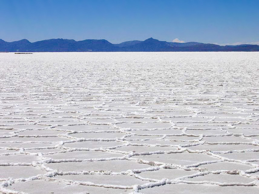 |
| Salar de Uyuni, Bolivia. Anouchka Unel, Wikimedia |
Some dry lakebeds may still accumulate some water in the wet season or during storms, either forming shallow, temporary lakes, or covering the lakebed in mud.
A similar structure, called a sabkha, can form along dry coasts where a coastal depression is only occasionally flooded by storms or very high tides.
Examples: Salar de Uyuni (Bolivia), Death Valley (California), Etosha Pan (Namibia),
Dimensions: Dry lakebeds are, naturally, about as big as lakes. The world’s largest salt flat, Salar de Uyuni, is 80 km across.
Impact: Dry lakebeds are very inhospitable, and salt flats in particular are hostile to any life not adapted to the concentrated brine that any water there becomes. Much life has adapted to these conditions, however, including shrubs, grasses, and even fish and other marine life that live in the temporary wet-season lakes and then survive through the dry season in cocoons or through salt-tolerant eggs. This is all true of less salty lakebeds as well, which also provide vital sources of water for animals.
Humans and cattle can use these water sources as well, and also dig wells to extract the groundwater that remains under these lakes in dry seasons. The evaporites can also be extracted for various uses, which I’ll describe when we discuss natural resources in the future.
More recently, flats have been used as essentially ready-made airstrips and highways. But flats with seasonal water cover tend to form mud, and so become barriers to vehicle travel instead.
Dune
 |
| Rub' al Khali, UAE. Nepenthes, Wikimedia |
Mounds of sand or other loose soil moving under the influence of wind. Both wind and water (and any other moving fluid) will shape soil into various bedforms due to irregularities in fluid flow that are then reinforced by the presence of the bedforms themselves (each bedform interrupts the flow of fluid in such a way as to encourage the formation of the next bedform downstream). They mostly share the same asymmetric triangular coss-section: the fluid pushes soil up the shallower side facing into the flow (the stoss side), and on reaching the peak it’s pushed over the edge and falls down the steeper slip face on the lee side, such that the bedform migrates downstream over time. The size of the soil clasts and flow velocity of the fluid determine the basic forms, and variations in the direction flow modify these forms.
 |
| Paleontological Research Institute/Wikimedia |
Fluvial bedforms are generally too small and ephemeral to be
called “landforms” (save for the aformentioned scablands formed by catastrophic
flooding), but for completeness I’ll list out all the typical forms here for
unidirectional flow (fluid consistently flows in one direction), in rough order
of increasing flow velocity or clast size:
- Lower Plane Bed refers to the flat surface formed at very low flow velocities; some fine soil may be slowly moved along, but not enough to form bedforms.
- Ripple Marks are the first true bedforms to form at low velocity, and are quite common on riverbeds and beaches. They are low, parallel ridges, rarely more than a few cm high. At low velocities these are straight and perpendicular to the direction of flow, but at greater flow velocities/clast sizes they become more undulatory, forming repeating s-shaped curves.
- Sand Waves are similar to ripple marks, but returning to straighter ridges with shallower stoss sides and more spacing between peaks.
- Dunes are similar to ripplemarks in appearance, but much larger, often m high. At lower (or inconsistent) velocities they may have superimposed ripple marks, but at higher velocities they’ll have smoother surfaces, and eventually flatten out.
- Upper Plane Bed is a flat surface that forms at high velocities, when the flow is strong enough to flatten out dunes completely.
- Antidunes form at very high velocities, when turbulence in the fluid forms standing waves: now rather than soil being pushed up on the stoss side and deposited on the lee side, soil is stripped from the lee side by the descending wave and then deposited on the stoss side as the water bounces back up. The resulting bedform is about as large as a dune but more symmetrical, and migrates upstream.
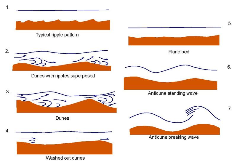 |
| A more detailed list of bedforms with increasing flow velocity. Dept. of Transportation |
Wind will make all the low-velocity forms, but rarely gets powerful enough to make antidunes, so dunes are the most prominent eolian bedforms. They can be further subdivided into different structure formed by different wind patterns and levels of soil supply:
- Barchan
dunes form where the winds are consistently in one direction and there is too
little soil to cover the whole region. The soil gathers into single dunes
(often forming in lines aligned with the wind direction) with a crescent-shaped
ridge and “horns” extending downwind on either side around the sheltered slip
face.

Wikimedia
- Transverse
dunes form when there is more soil and neighboring barchan dunes join together
into long, assymetrical ridgelines perpendicular to the wind direction, like
ripple marks.

Po ke jung, Wikimedia
- Longitudinal
dunes (A.K.A. seifs) form when the wind direction
frequently shifts between two or more directions, but still with an average
overall trend (e.g., wind switching between blowing northeast and southeast
such that there is an average push east). Soil gathers in a long, symmetrical
ridgeline parallel to the average direction; as wind direction shifts, soil is
alternately pushed from one face to the other, but overall migrates along the
ridgeline.

Po ke Jung, Wikimedia
- Star
dunes form where wind direction frequently shifts between many different
directions, with no overall trend. A pyramid-shaped dune forms with three or
more faces, and soil moving between different faces as wind shifts around.
Georg Gerster, USGS - Parabolic
dunes form where there is some vegetation, often on beaches. Wherever soil is
exposed, wind will pile it up into a dune and it will start to migrate
downwind, but vegetation will hold the ends in place, such that a crescent
shape forms but reversed from a barchan, with the horns extending upwind. The
vegetation (and presence of some water) makes these far more stable and slower
to migrate.

Po ke jung, Wikimedia

Individual dunes may form wherever there is loose, exposed soil (generally this requires arid conditions as water will either erode away the soil, bind it together, or grow vegetation, but wave action on beaches or strong winds can also inhibit these processes) but arid regions can develop vast ergs (A.K.A. sand seas) covered in numerous migrating dunes, with stable sediment either buried completely or visible only in the low points between dunes.
Dunes and ergs have been spotted on several other bodies, including Mars, Venus, and Titan. Even comets can have dunes formed by the flow of ice vapor over their surfaces.
Dimensions: Fluvial dunes and antidunes are typically only m high, but eolian dunes are often 10s of m, up to over a km, and usually around 10 times as wide. Transverse or Longitudinal dunes can extend for 100s of km. Note, though, that dunes can migrate up to 100s of m per year, and so often aren’t marked on maps (save those produced from radar topography). Ergs can cover 100s of thousands of km2 with sand 1s to 100s of m deep.
Impact: The loose, constantly shifting surface of dunes generally makes them unsuitable for vegetation and construction—though they only really form where there is no vegetation in the first place, so the former is a moot point, and vegetation does sometimes manage to grow on parabolic dunes. Even just walking over dunes is harder than over hard ground, and any construction within an erg requires not just clearing dunes away but preventing new ones from forming or migrating in. Thus even today ergs are largely uninhabited, save for nomadic groups moving across them or resource extraction efforts.
Where ergs border on wetter regions, the migrating dunes may bury vegetation, killing it and so freeing up more soil, gradually expanding the erg in a process of desertification. But in other circumstances, plant growth on the edge of an erg may bind up soil and draw water to the surface. As both of these processes are self-reinforcing, subtle shifts in climate can significantly move the boundaries of deserts.
Ventifact
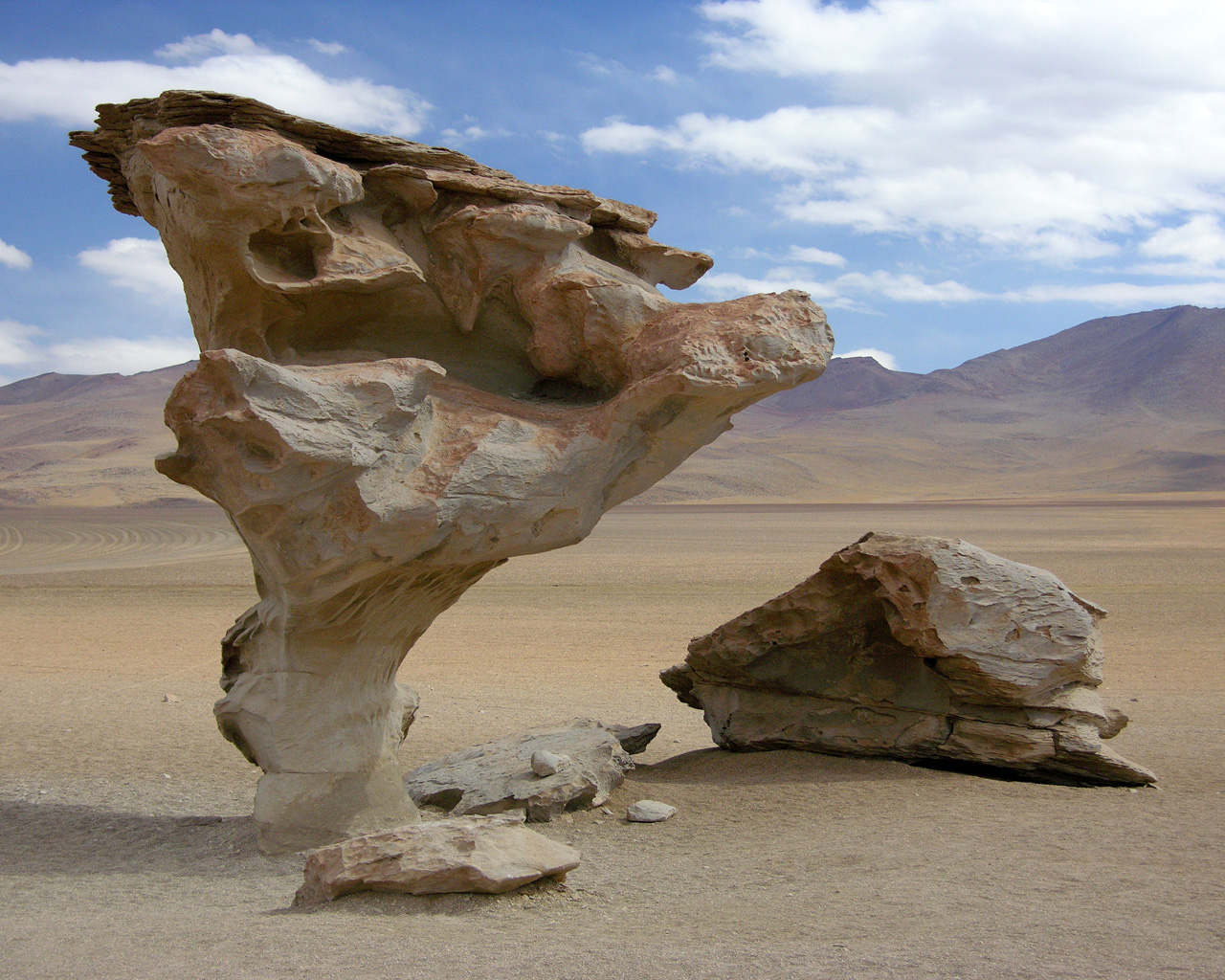 |
| Árbol de Piedra, Bolivia. El Guanche, Wikimedia |
A promontory or rock that has been rounded by prolonged wind erosion. Whereas fluvial erosion tends to cut channels into exposed rock with sharp ridgelines between them, eolian erosion can be more even. The strongest erosion is done by the sand particles carried by the wind rubbing against the ventifact, so depending on its material properties and the sand available, it may either be smoothed by blasting with fine particles, or the sand may cut deep into existing weaknesses and form deep grooves. The wind will carry more sand closer to the ground, so tall ventifacts may be more deeply eroded near their base and broaden out to form an odd mushroom shape.
Packed sediment that lacks the cohesion to form such a shape may instead form a yardang, an elongated structure parallel to the wind direction that resembles the upturned keel of a boat
 |
| Nunavut, Canada. Mike Beauregard, Wikimedia |
Oasis
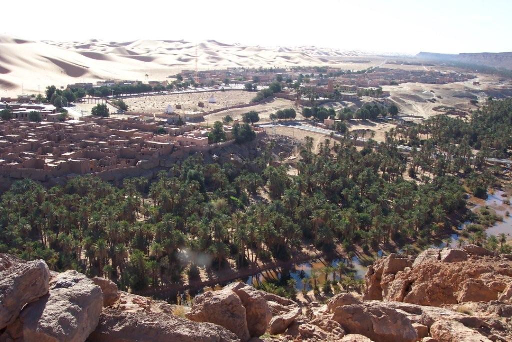 |
| Taghit, Algeria. CIA World Factbook |
A water source that reaches the surface in an otherwise arid region. We’ve already discussed how rivers and lakes can act as oases, but isolated oases can also form from to underground aquifers; water is trapped between impermeable layers of rock somewhere deep underground, but can reach the surface through a crack, fault, gap in the rocks, or artificial well, and rises due either to high pressure in the aquifer or active pumping, or seeps through permeable sediment. The water in the aquifer may come from occasional storms, underground flow of water from wetter regions, or fossil water—left over from a time with wetter climates thousands of years ago and trapped underground ever since.
An oasis may just be a patch of vegetation growing in moderately wetter soil, but many have persistent ponds or lakes on the surface. Vegetation can grow in a significant area around the water, though if the oasis is in an erg than the boundary may be marked by constant competition between vegetation stabilizing the soil and encroachment by dunes and loose soil.
Examples: Al-Ahsa Oasis (Saudi Arabia), Taghit (Algeria), Fish Springs (US), Yueyaquan (China)
Dimensions: The smallest oases may be just a small patch of vegetation, but the largest can be km across. Al-Ahsa Oasis is 85 km2 in area and fed by 280 wells from the same aquifer.
Impact: These are, of course, vital sources of water and food in arid regions. Well-placed oases can allow passage through deserts and so take on great economic and strategic importance, though some may be used mostly just by local nomads. As mentioned, many oases have been created or expanded by the digging of wells, some of which have been carefully maintained for centuries. A large oasis can even support large settlements and fairly productive agriculture of plants native to the arid climate, and may help support other nearby resource extraction efforts.
In recent years, some nations have attempted to tap aquifers to support large cities and vast agricultural regions in deserts, though these are either limited by the rate at which aquifers are refilled by water, or in the case of fossil water, reliant on a—though vast—ultimately finite water supply.
Coastal
 |
| Porto Covo, Portugal. Alvesgaspar, Wikimedia |
Starting out at the broadest scales, the general “character” of a coastline is determined in large part by its tectonic setting:
 |
| West coast of South America (north to the left, hence the fjords on the right). As before, these are made in Google Earth with this overlay. |
Active Margins (Americas west coast, New Zealand) tend to mark out sweeping arcs at large scale, as a consequence of how tectonic plates move over the Earth’s curved surface, but on smaller scales the coastline itself will often have a more knobbly appearance, as uneven tectonic stresses push some coastal areas up and allow others to erode down, and there may also be occasional faults and small islands.
As I’ve mentioned, during an ice age glacial erosion near the poles will form fjords along the coast and even divide up parts of the mountains into islands. Usually these fjords shouldn’t cross the middle of the range unless the lowlands on the other side are also flooded and so sea level may have risen enough to cover the cols between glacial valleys on either side of the range.
 |
| East coast of North America. |
Passive Margins (Americas east coast, Eurasia north coast, Africa, India, Australia) will tend to form straightish lines or gentle curves at large scale, without quite the same tendency towards circular arcs specifically. However, more complex features can be formed by preexisting topography: old, inactive mountain ranges may be unevenly eroded, such that only scattered highlands remain.
Usually sediment eroded off these highlands should fill in the areas between them to form broad coastal plains, but a rise in sea levels may flood across them, leaving the highlands either as broad islands or peninsulas (Ireland, Scandinavia, Newfoundland) or scattered islets (Hebrides, coastal Maine). This can occur at high latitudes during ice ages, when glaciers push down or carve out the lowlands and then flood them when they melt—producing the complex northern coastlines of modern North America and Europe—or more evenly across the world in warm periods with particularly high sea level. Because the ridgelines of these highlands aren’t necessarily parallel to the coastline (as is usually the case for active margins), these coastlines can often have a particularly jagged appearance as water floods into the valleys between ridgelines.
At finer scales the character of the coast will be determined largely by the form of its estuaries, which we’ll discuss in a moment.
 |
| East coast of Asia. |
Trailing-Edge Active Margins (Asia east coast) essentially combine the features of active margins on their outer coast and passive margins on their inner coasts.
 |
| Mediterranean. |
Enclosed Seas (Mediterranean) are a mishmash of different features; Small sections active-margin and passive-margin regions may be mixed together on one coastline due to the complex patterns of tectonic motion. Local slab rollback may cause hilly areas to subside into the sea (e.g. the Aegean), creating complex coastlines similar to those formed along passive margins during sea level rise.
Tectonics factor into some of the small-scale characters coastlines as well; uplifting active margin coasts will be generally eroding down and tend to form cliffs and rocky shores, while mature passive margin coasts will tend to deliver more sediment to their coasts such that they have sandy beaches—though by no means are cliffs absent from passive margins or beaches absent from active margins.
But past that, most of the fine details are determined by erosion and deposition. Most coasts experience significant fluvial erosion—though some are more dominated by glacial or eolian erosion—but there are a couple other forces at play as well:
Waves are constantly beating at the shore of most coastlines. At a fine scale, the repetitive back-and-forth motion will work to erode at the rocks directly exposed on the coast. However, waves do not always meet the shore head-on, pushing beach sediment somewhat to the side as well as onto shore. If waves consistently meet the shore at a similar orientation, this repeated sideways push can cause longshore drift, pushing sediment laterally along the shoreline. Even if wave direction regularly changes, alternating longshore drift can distribute sediment to smooth out shorelines.
 |
| Longshore drift by back and forth ("swash" and "backwash") motion. Fiveless, Wikimedia |
Waves are ultimately caused by the wind, and wave erosion will generally be strongest in areas with strong prevailing winds blowing onshore (the wind direction also determines the direction of longshore drift). The size of the body of water also factors in; lakes and sheltered bays will generally have smaller waves. But even if a coast experiences little wave erosion most of the year, large storms may cause significant erosion in a short period.
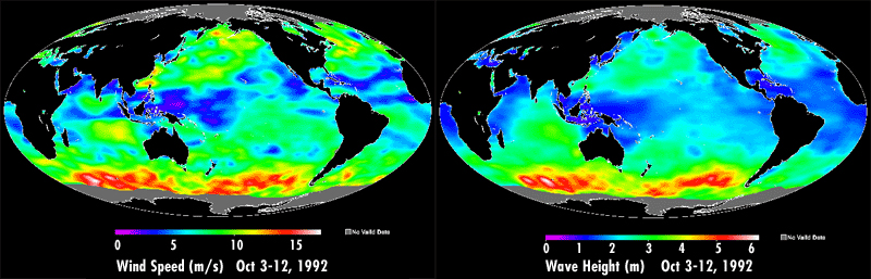 |
| Global wind speed (left) and resulting wave height (right). NASA/JPL/Caltech |
In short; expect wave erosion and associated longshore drift to be a major factor for coastlines facing into strong onshore winds off major bodies of water, especially regions with frequent storms such as subtropical western coasts. Bear in mind too, however, that the actual formation of coastal landforms will depend on the availability of fine sediments.

 |
| Based on prevailing winds simulated by ExoPlaSim (above), an estimate of which coastlines of Teacup Ae are likely to experience particularly strong (red) or weak (blue) wave action. I've also marked coastlines likely to experience strong longshore drift (white arrows). |
Tides are similar to waves, frequently switching direction and moving coastal sediment as they do. But they are of course slower to change direction, and can have much larger amplitudes than waves such that they affect broader areas. Coasts often have an intertidal zone, between the high tide and low tide lines (though where tides are caused by multiple bodies, such as on Earth, these boundaries can shift some depending on how those bodies align) with various unique features.
The dynamics of tides are rather complex to calculate directly, as the exact period of tidal forces, width of ocean basins, and interaction of waters between basins can cause various resonances to form that either enhance or dampen tidal motion. However, there are a few common patterns:
- For one, large tides occur only where there is a large body of water that a tidal bulge can move across with little obstruction, so expect big tides on open oceans and small ones in inland seas or coastal seas sheltered by major island chains (the threshold here is higher than for waves, so e.g. the Mediterranean has significant wave action but very moderate tides).
- Large tides also require a major landmass blocking the motion of the tidal bulge, such that water piles up along the coast at high tide and is drawn away with no water to replace it at low tide, so expect big tides on the coasts of continents and small tides on small islands in the ocean.
- Large gulfs and bays can act to funnel water towards their deepest point (as
in, furthest from the open sea, not depth of seabed), creating large tidal
ranges there. In some cases, such as at the Bay of Fundy, a hook-shaped coastline can trap moving water and create especially large tides
- Finally, the slope of the coast also factors in; a small tidal range can still cause large horizontal motion of the shoreline if the shore is very shallow. When a large tidal range is combined with a shallow coastline, the resulting current of water moving large distances up and down the beach can be quite strong.
 |
| Average range of the lunar tides. R. Ray, NASA |
 |
| Areas of Teacup Ae likely to experience particularly strong (red) or weak (blue) tidal action (though I haven't bothered to mark the low tides across the open oceans). |
Wave and tidal erosion are both strongest at the water’s surface, and don’t have as much of a vertical tendency as our previous erosive forces; overall they will tend to gradually pull sediment off land and deposit it into deeper water, but mostly they will tend to move material laterally along coastlines; rather than moving sediment from higher elevation to lower elevation, they’ll tend to move sediment from more exposed headlands to move sheltered coves and inlets. Thus, much as above-water erosion and deposition will act to flatten terrain, wave erosion and deposition will act to straighten beaches, though they may prevented by tectonic action or above-water forces.
The other erosive forces are still at play and often work in concert with wave and tidal erosion to pull down steep cliffs, so there’s still a tendency for coastlines to become gradually shallower over time, transitioning from cliffs to coastal plains. But because of the lateral movement of sediment and uneven action of other forces, any single coastline is often a mix of cliffs, beaches, and intermediate structures.
Ocean currents also have a subtle effect: a strong ocean current running along a coastline may prevent deposition of sediment that might form protruding landforms like river deltas, instead carrying it down the coastline. This will tend to happen where a current runs straight into and then is deflected by a coastline, and there are no outer islands or banks to block it.
 |
| Major ocean currents of Teacup Ae (white arrows) and areas where they are likely to strongly influence coastal deposition (red). |
One final element to consider is sediment supply: the amount of sediment delivered to the coastline from the landmass’s interior, primarily at river mouths by fluvial erosion. This will be spread across the coastline by wave and tidal action, forming beaches that protect the coast from erosion. A high sediment supply can overcome loss of sediments to deeper waters and cause the landmass to expand into the sea, forming a broad coastal plain. A low sediment supply will allow waves and tides to erode into the coast, generally forming a steeper coastline.
The sediment supply in any one spot will be impacted by the size of nearby river’s drainage basins (larger drainage basins supply more sediment), the terrain in the drainage basins (young mountains will provide more sediment than flat plains), and the climate (dry areas will experience less erosion and so supply fewer sediments, and often form endorheic basins anyway):
- Along active margins, rivers will carry plenty of sediment, but each outlet individually will draw from a small drainage area, and the sediment they do supply will be more quickly lost down the steep submarine slopes towards the subduction zone. Some larger rivers may form small coastal plains, but for the most part sediment supply is fairly low relative to erosive losses.
- Along passive margins, drainage basins will be larger, but even a large drainage basin will supply little sediment if it includes no major highland source regions or is mostly dry. Older highland regions may also block drainage such that, like active margins, they have fairly little sediment supply on their coastal side.
- The the most sediment supply, then, will usually be on the passive margin coastlines of continents that also include active margins or other active orogenies that could feed sediments to the rivers draining along that coastline, and an overall wet climate.
 |
| Likely major drainage divides (purple lines) of Teacup Ae, with resulting general river flow (teal arrows), and resulting coastlines with high (red) or low (blue) sediment supply. |
Sea Cliff
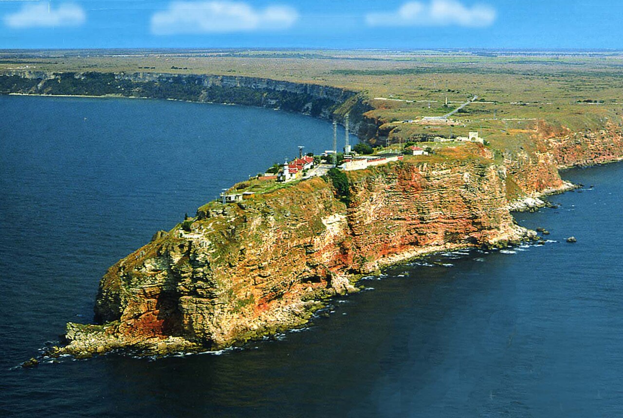 |
| Kaliakra, Bulgaria. Spiridon MANOLIU, Wikimedia |
A shear cliff directly on the coast. While uplift or sea level change is ongoing, hills and mountains may slope directly into the sea, but once the coastline stabilizes, waves will begin cutting away at the shore. At first, loose soil on the slope may slide down to replace what is lost, and sufficient sediment supply may eventually form a beach that prevents further erosion. But with low sediment supply, the waves will eventually cut through to more stable sediment or rock. Erosion is fastest at the base of the slope, so it will become steeper over time.
Though more exposed sections of coast will generally experience more erosion, straightening it out over time, irregularities in the rock or interactions between erosive forces can cause more complex patterns:
- Waves may cut into a fault or weak section of the
cliff, forming a long inlet sometimes called a geo.

Calder's Geo, Scotland. Richard Kay, Wikimedia - They may also erode around a tougher section of
rock, eventually isolating it from the mainland as a tall stack. These may first form level with the cliff, but will shorten over time as the gradally collapse.

Ponta de São Lourenço, Portugal. Richard Batz, Wikimedia - When it first forms, the stack may remain
connected to the mainland by a bridge of rock above the water level (as erosion, forming a
natural arch. Eventually the arch will widen enough that it will collapse, leaving a stack.
%2C_by_Klugschnacker_in_Wikipedia_(31).JPG/1024px-Praia_da_Marinha_(2012-09-27)%2C_by_Klugschnacker_in_Wikipedia_(31).JPG)
Praia de Marinha, Portugal. Klugschnacker, Wikimedia - In karstic regions or other areas with irregular
weaknesses in bedrock, wave action may erode into the cliff to form a cave. Waves entering the cave will slosh around inside, widening them and possibly breaching the surface above to form a blowhole that sprays water upwards.
_-_geograph.org.uk_-_849913.jpg)
Caves by the Gobbins, Ireland. Albert Bridge, Wikimedia
Sea cliffs aren’t just limited to coastal highlands: anywhere with low sediment supply and strong wave action will erode inland, and all landmasses tend to slope up from the sea to some extent and usually have harder sediment or bedrock not too far below the surface, so a cliff will form sooner or later (though generally the more complex features require hard bedrock). Even in regions with high sediment supply, cliffs may form on more exposed headlands. Sea level rise can also cause more cliffs to form, as it will take some time for sediment to fill in coastal waters back up to sea level and form beaches again.
Cliffs may also form for other reasons—fluvial or glacial erosion, jökulhlaups, tectonic faulting—and sea level may then rise to meet the cliff. Even with high sediment supply, it may, again, take some time for sediment to pile up to sea level.
Examples: Cliffs of Dover (England), Cape Point (South Africa), Los Gigantes (Canaries)
Dimensions: Generally 10s to 100s of m tall, up to over a km, and up to 100s of km long (though often interrupted by inlets and beaches).
Impact: Various plants and animals favor sea cliffs, as they’re safe from larger predators; especially flying animals, which can easily access them. For humans, they may invonvenience access to the sea and travel along the coast, but they can also be useful for placing defensive fortifications, and have also been favored for their scenic vistas. But over the long term, any construction on top of a sea cliff is at peril of collapsing into the sea as the cliff erodes away.
Wave-Cut Platform
 |
| Southerndown, Wales. Yummifruitbat, Wikimedia |
If a sea cliff is cut into sediment, wave and tidal action will tend to erode away sediment under the cliff to form a gradual slope into deeper waters. But if it’s cut into bedrock, it may resist this erosion better. Waves will cut away into the cliff at the water’s surface, and the above cliff will collapse down as it does so, but the rock below may remain as a flat platform just below the water, often exposed at low tide. Given enough time for wave erosion at the same level, the platform may become quite broad.
The platform will still erode to some extent, sometimes cutting deep grooves through it or carving out hollows that form tidal pools; submerged at high tide but then exposed at low tide but still retaining some water.
 |
| Eilean Fladday, Scotland. Peter Paalvast, Wikimedia |
If sediment supply increases, a beach may eventually form on the platform. Sea level fall or uplift may also push the platform above sea level, forming a terrace that may be covered in sediment and vegetation; in some cases the process may repeat, forming a series of terraces.
Dimensions: 1s to 100s of m across, and can stretch as long as sea cliffs.
Impact: Tidal pools and other small spaces in the platforms can act as sheltered nurseries for a variety of marine lift. The platforms can be used for movement along shorelines at low tide, though this comes with the risk of being trapped at high tide. Piers and other coastal constructions can sometimes be built on the platforms
Beach
 |
| Hyams Beach, Australia. Dave Naithani, Wikimedia |
Given time, pretty much any coastline will accumulate some sediment; even if sediment supply from inland is low, some will erode directly off the coastline, and it can also be delivered from the sea itself (typically by the breakdown of animal shells). Waves may sweep this away from more exposed headlands, but at the same time it will accumulate in more sheltered coves. Some of this sediment may be swept out to deeper waters as well, but at least some will remain to build up at the base of seaside cliffs. Thus, if no other forces interfere, eventually the sediment will build up to the water’s surface along at least part of the coast. And indeed, many cliffed coastlines have beaches at the cliff’s base in more sheltered areas.
The same waves and tides that removed sediment before will now act to broaden it to form a shallowly sloping bed across the intertidal zone. Much as with rivers, the dominant clast size tends to depend on the strength of water flow; very strong waves may leave only pebbles and cobbles on the beach, while weak waves may allow for fine silt to deposit. But this also depends on the sources of available sediment (you won't find many cobbles on the shore of a broad coastal plain), and many beaches have a mix of clast sizes from different sources.
Variation in sediment source can also create a broad range of colors:
- Sediment delivered by rivers will often by white or yellow along passive margins from heavily weathered grains of quartz and limestone.
- Those along active margins will often be more orange or red from less-weathered soil containing more iron.
- Near hotspots or other areas with more effusive volcanism, they may be black from basalt and obsidian, red from oxidized iron, or rarely green from olivine.
- Many tropical beaches are white or pink from the carbonate shells of the coral and shellfish in the rich marine ecosystems just offshore.
- Beaches formed primarily of sediment eroded directly off of nearby cliffs will contain the same material, though the smaller, somewhat weathered grains will appear somewhat different in color, often brighter and paler; most often they’re yellow, orange, black, or grey.
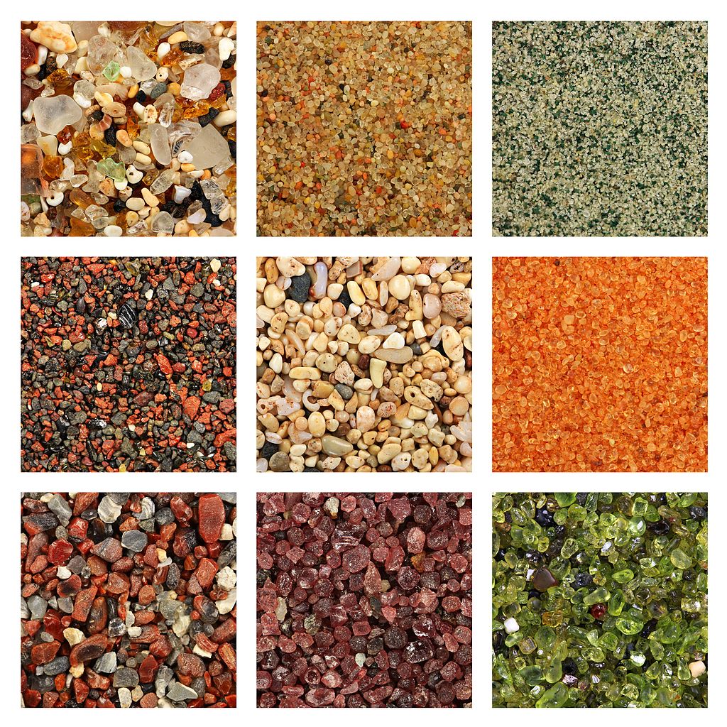 |
| Various samples of sand. Numbered left to right and row by row: 2, 6, and 8 are desert sand; 3 is a passive margin beach; 7 is an active margin beach; 4 and 9 are hotspot beaches; 5 is a tropical beach with coral; 1 is hotspot beach with coral and human glass mixed in. Siim Sepp, Wikimedia |
Waves will also spread the sediment up and down the coast. For a steep coastline this leads to a moderate straightening of the coastline—as already discussed—but for a shallow shoreline and high sediment supply, this can form a continuous beach along a mostly straight or gently curving coastline.
Longshore drift complicates the process: drifting sediment
will gather on the updrift side of headlands or gather between coastal islands
and the mainland to form a bar of sediment called a tombolo connecting
them, and beaches may extend past the downdrift ends of peninsulas to form spits
or across the openings of inlets to form baymouth bars. Complex wave patterns may sometimes cause opposing directions of longshore drift on the same coastline, creating a pointed cuspate foreland between them
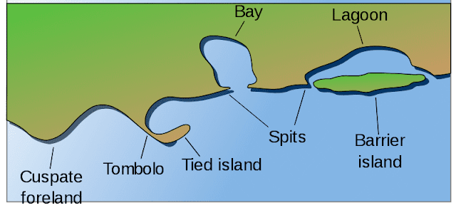 |
| Common beach features. Surachit, Wikimedia |
A sandy beach will often be topped by a berm, a low ridge formed by sediment thrown up beyond the high-tide line by crashing waves. Below the berm, the beach may vary in size across seasons; in winter, rough weather will erode away much of the beach and pull the sediment offshore, but gentler waves in summer will push this back up to form a broader beach. Some sediment is permanently lost to deeper waters each winter, so beaches will gradually erode inland if not supplied with sediment from elsewhere. While the breach exists, it blocks erosion of inland rock, so coasts with poor sediment supply often exist in a state of equilibrium where some beaches exist in sheltered coves, but they can only get so big before they would block the erosion of headlands that supplies their sediment.
 |
| Roger Williams University |
Behind the berm, excess sand may be piled up into dunes, most commonly in mid-latitudes where strong seasonal shifts in temperature and winds tends to ensure there is strong onshore wind at least part of the year.
Examples: Praia do Cassino (Brazil), Jersey Shore (US), Eighty Mile Beach (Australia; 140 miles long), 90 Mile Beach (New Zealand; 55 miles long)
Dimensions: Anywhere from m to km across from the low-tide line to inland vegetation—varying with the seasons—and individual sandy beaches can stretch for 100s of km along the coast. Berms are typically cm to m high. Roughly 1/3 of the world’s coastlines have sandy beaches.
Impact: Numerous animals and plants have specifically adapted to live in the intertidal sediment, sheltering in the sand or underneath rocks at low tide and at at high tide, safe from predators in the shallow water; though terrestrial predators have also adapted to feed on them and edible flotsam at low tide. The shallow sediment just offshore also makes for an ideal environment for various shallow-water species, similarly sheltered from deep-water predators. A variety of predominantly marine species have also adapted to crawl onto beaches for either rest or to lay eggs in the sand.
Beaches have, of course, also become popular for human recreation. However, human activity and construction on beaches often disrupts the erosion, sediment movement, and vegetation that supplies and stabilizes these beaches, resulting in gradual loss of sediment and exposure to inland terrain to coastal erosion.
Barrier Island
 |
| Assateague Island, Maryland. USGS |
Long, sandy islands separated from the mainland by shallow water.
These can form on shallow coastlines with some wave action, low or moderate
tides, and a high sediment supply. Sediment is spread out by waves into a
broad, arcing beach backed by a berm, and then storms and tides flood the low
area behind the beach and erode it out to form a lagoon. They may also form as spits off the end of beaches that are eventually cut off
from the mainland as storms cut channels across them.
In some regions such as the US East coast, sediment from multiple rivers contributes into a single long line of barrier islands (and similarly-formed barrier peninsulas still connected to the mainland) giving the coastline something of a smoother “outer” coastline along the islands and a far more jagged “inner” coastline along the mainland.
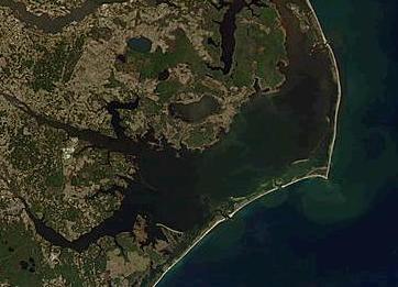 |
| Pamlico Sound, US. NASA |
Naturally, this requires that the coastline be fairly shallow and experiencing little in the way of uplift or post-glacial rebound—some subsidence or sea level rise may even help barrier islands form; so, passive margin coastlines are best, though they can also form across the estuaries of large rivers along active margins.
Much as with mainland beaches, the sediment on barrier islands shifts with the seasons and, with little adjacent rock or vegetation to stabilize it, the entire island can gradually shift over time; in some cases, large storms can sweep away or shift islands over the course of hours.
Examples: Carolina Outer Banks (US), Wadden Islands (Northern Europe), Moreton Bay (Australia)
Dimensions: Typically 5 and up to 50 km from the mainland coast, 200 m to 3 km wide, 10-100 km long (shorter with stronger tides), and rarely more than 5 m high. Neighboring islands form a continuous line that may extend for thousands of km and the gaps between them are usually no more than a few km wide. Altogether, about 15% of Earth’s coastlines have barrier islands
Impact: Much the same as beaches, and I’ll discuss the impact of lagoons in a moment, but I feel it bears mentioning that constructing houses on islands that are naturally a bit ephemeral and mobile is perhaps a bit foolhardy.
Lagoon
 |
| Venice Lagoon, Italy. NASA |
A shallow body of usually salty water along a coastline separated from the open ocean by a thin strip of land. These usually form due to storm and tidal erosion behind beaches (which become barrier islands or peninsulas) or extension of beach spits across bays, but the term is sometimes also applied to the shallow waters behind barrier reefs or within atolls (both of which I’ll describe later), broad sections of river estuaries, or any other sheltered inlets and bays.
The lagoon may often be flanked by tidal flats, shallow beds of sediment deposited between the low and high tide lines—much like beaches, but sheltered from ocean waves and so flatter, broader, and less regular in shape. Without waves, finer sediment can deposit here and remain stable enough for plant growth, developing into a salt marsh inhabited by plants adapted to the salty conditions and inundation of water at high tide. This may stabilize the sediment further and allow more to gather, eventually filling in the lagoon, though this may be offset by continued storm and tidal erosion. In warmer climates even trees called mangroves can grow in the water, sometimes forming vast submerged forests.
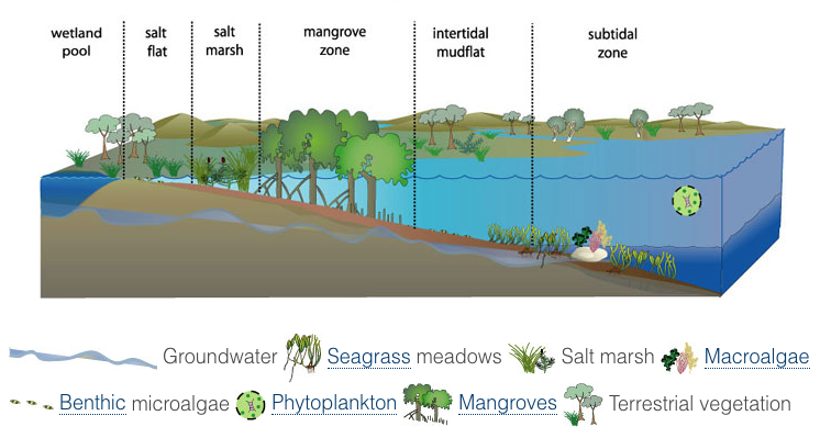 |
| Typical vegetation on the shore of a lagoon or estuary. OzCoasts. |
Examples: Venice Lagoon (Italy), Pamlico Sound (US), Wadden Sea (Northern Europe)
Dimensions: Small lagoons can be just m across and the largest can stretch for 100s of km. In either case, they’re usually longer along the coastline than deep inland, and usually broader than their confining barrier islands.
Impact: Coastal lagoons combine much of the ecological significance of beaches, tidal pools, and wetlands: They have access to the ocean and often salty water, but are sheltered from waves and deep water predators, and if connected to inland rivers may contain rich soil and suspended nutrients. Salt marshes and mangrove forests provide shelter for large varieties of small or young animals, and also help to control tidal erosion and storm surges, thus stabilizing the coastline.
Estuary
Region where a river meets the sea or another large body of water such as a lake. As the river water enters with the sea, it slows and deposits most remaining sediment.
However, sea level rise over the last 20,000 years has flooded over these sediments and inundated river valleys, forming long inlets called rias (or fjords in glacial valleys). As sea levels have stabilized over the last 7,000 years, rivers with high sediment supply or shallow rias have managed to fill them in with sediment and continued piling up sediment into river deltas reaching out into sea. Some are also in a transitional state, having not completely filled in their ria but still depositing enough sediment to form a delta within the ria.
Naturally, the nature of estuaries at other points in Earth’s history or on other worlds will depend on the recent history of sea level change. A world with more recent sea level rise will have few deltas and many large rias; one with more stable sea levels will allow more rivers to develop deltas; and one with recent sea level decline may have no or very few rias (local tectonic subsidence or faulting may still form a few) and many deltas, some of which may form conical structures like alluvial fans on steeper coastlines (we can see some such structures in lakes with declining water levels today).
Ria
 |
| Marlborough Sounds, New Zealand. Phillip C., Wikimedia |
Inlets formed when sea level rises and the ocean floods into a nonglacial river valley (as opposed to fjords formed in glacial valleys). In most cases this will appear just as a gradual widening of the river along its estuary. However, if the coastline before flooding was fairly steep, the sea may flood into the river’s tributaries as well, forming a complex coastline of inlets and peninsulas, reflecting the dendritic drainage pattern of the former river.
This is essentially the pattern many simple terrain generators are trying to replicate, though as we’ve discussed this isn’t really appropriate for all coastlines.
Examples: Chesapeake Bay (US), Bay of Kotor (Montenegro), Pearl River Estuary (China), Sydney Harbor (Australia)
Dimensions: Large rias can extend up to 100s of km inland, appearing as large bays more than river estuaries, but most are thin inlets. A large ria doesn’t necessarily have a large river feeding into it, though there is some correlation.
Impact: Much as lagoons, the shallow, sheltered waters of rias can make a good home for a variety of small or young marine life. The often steeper coasts aren’t as suitable for salt marshes or mangrove forests, but they are more convenient for some human uses; docks can be more easily built directly on the shore and deep rias may allow ocean-going vessels with deep keels to access port cities far from the coast (and so sheltered from storms or coastal raids).
However, rias can also funnel tides into their ends, sometimes forming powerful tidal bores, and they can do the same to tsunamis.
River Delta
 |
| Indus River Delta, Pakistan. NASA |
A region of sediment deposited in an estuary. Even if a
river hasn’t filled in its ria, it may form a delta at its mouth where it
enters deeper water; but a river on a shallow coastline with substantial
sediment supply (or one on a world with more stable sea level) and no strong currents
directly offshore may extend far out to sea.
The water slows as it meets the sea (or other body of water)
and deposits out much of its sediment into shallow bars. Tides, waves, or storm
surges will cause flooding and erode at the channel banks, and so—much like
braided rivers—new channels form frequently. Some may be short anabranches, but
many will flow directly to the nearby shoreline. Thus rivers often branch out in
their deltas, in something of the reverse of the dendritic pattern seen in highland
streams. As the delta grows, older channels may eventually be abandoned as
water flow shifts elsewhere; the coastline in these inactive areas may erode
back some, but vegetation growth will eventually help reduce erosion and
transition these regions into coastal plains.
 |
| Growth of the Yellow River Delta, 1989-2009. NASA |
The features of the delta depend largely on the relative influence of the river’s sediment supply, waves, and tides. Note also that these influences can sometimes vary across regions of a delta; for example, a delta formed in a sheltered inlet may be largely river- or tide-dominated, but features of a wave-dominated delta may form at the end of the inlet.
 |
| Seybold et al. 2007 |
- River-Dominated
Deltas are formed by rivers with weak wave
or tidal action; strong sediment supply also helps but really it's the absence of other forces that defines these. Sediment deposits mostly on the banks of the river and remains
there to form levees along its course, causing the mouth to extend further out
into sea over time, creating an elongate delta with channels extending
far out to sea flanked only by their thin levees. Occasional flooding may
overflow the levees to form distributary channels—though these will often fill
in over time, so small distributaries are more common in the young, low
sediments near the river mouth, extending out in all directions and branching
further to form a “bird’s foot” pattern (the channels appearing like toes on
the end of a long foot).
Once the mouth has extended out a great distance, an especially high flood my carve out a shorter channel to the sea, which then becomes the primary path for water and sediment; the old channel is typically not abandoned completely, but water flow declines and it may erode back towards shore or eventually be blocked with sediment. A mature delta will have many of these former channels alongside its primary distributary.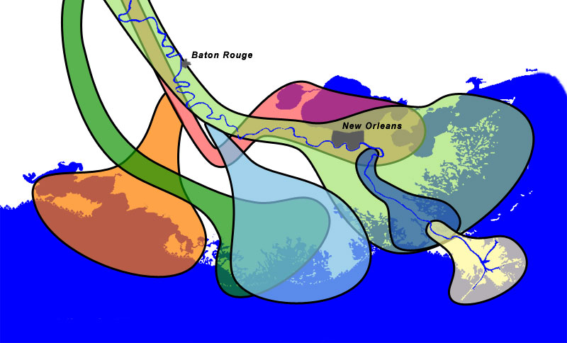
Regions of deposition in the Mississippi delta over the last 5,000 years. Wikimedia
As mentioned, a strong ocean current offshore may prevent a delta from extending out to sea, instead forming more of a fan shape as the river mouth shifts back and forth along the coastline (like the arcuate delta mentioned below but without the smoothed outer coastline).
 |
| Sequence of river-dominated (left) to wave-dominated (right) deltas: Mississippi (US), Yellow (China), Ebro (Spain), Nile (Egypt), Senegal (Senegal/Mauritania; note longshore drift), Curonian Lagoon (Lithuania/Russia). All of these are from Google Earth, NASA, or other government agencies. |
- Wave-Dominated
Deltas experience strong longshore
drift from frequent waves or storms, such that sediment depositing at the river
mouth is swept to either side and pushed up into a berm that blocks the
formation of distributaries. As such, they form a straight delta; the river
mouth extends no more than a short distance into the sea, with long sweeping
beaches to either side and no major distributaries. If longshore drift is
predominantly in one direction, the outlet may migrate downdrift such that the
river flows along the coast for some time before reaching its outlet.
Subsequent flooding may form a lagoon along the estuary bounded by barrier islands. Some features of river-dominated deltas may appear where the river enters the lagoon. -
Mostly
river-dominated deltas with some wave influence will instead adopt a lobate form; the delta will still still extend into the sea and form many
distributaries, with primary water flow switching between them, but waves will
act to smooth the outer perimeter such that rather than each channel extending out
on its own, there is more of a continuous bed of sediment with channels cutting
through it.
With weak wave influence, and the largest channel still reaches out furthest and forms something of a point, but with stronger wave influence the delta is smoothed out into more of a fan shape, sometimes called an arcuate form. Further wave influence will reduce the number of distributaries and flatten the delta against the coast, with the remaining river mouth forming a small, pointed protrusion, called the cuspate form. This is then flattened against the coast as we shift to more purely wave-dominated deltas.
 |
| River-dominated (left) to tide-dominated (right) deltas: Mahakam (Indonesia), Zambezi (Mozambique), Charente (France), Ganges-Brahmaputra (Bangladesh/India) |
- Tide-Dominated
Deltas have high tidal ranges such
that the shoreline shifts significantly every day and the flow of water regularly
shifts direction across much of the delta. This spreads out sedimentation a
good deal and inhibits the formation of thin, levee-bound channels. The river
thus adopts an estuarine form, with a long, often funnel-shaped channel
broadening far inland of the coast, flanked by shallow bars of sediment.
Smaller rivers with lower sediment supply often have a single outlet, but larger or more sediment-rich ones will form internal bars that divide them into into broad, parallel distributaries. In such cases there may often be no single dominant channel, and channels may split and rejoin several times rather than endlessly branching out. - Deltas
with a weaker tidal influence may extend further out to sea and less inland,
but still have broad channels within the delta and no dominant distributary.
- Deltas with a mix of wave and tidal influence will still have a generally estuarine delta, but may extend less out to sea and form barrier islands across the river mouth—though for stronger tide influence, these will often be shorter and more numerous, with broader gaps between them.
 |
| Wave-dominated (left) to tide-dominated (right) deltas: Rio Grijalva (Mexico), Wilapa Bay (US), Copper (US), Wadden Sea (Netherlands/Germany), Dyfi (Wales) |
Dimensions: Up to 100s of km across and extending up to a couple 100 km into the sea; though often they extend inland as well, including the flat delta sediments built up in the river’s former ria.
Impact: Deltas include many of the previous features we’ve discussed (beaches, barrier islands, lagoons, salt marshes, mangrove forests), with all their associated impacts. The sediment in the delta is often rich, fine soil, though the shifting of water channels and flooding by tides or storms may make habitation difficult. Often major cities will appear not within but alongside deltas, feeding off agriculture in the delta and fishing in the nutrient-rich waters offshore and providing an interface between traffic and shipping on the ocean and in the river; unlike rias, the shallow delta channels are rarely suitable for ocean-going vessels.
Reef
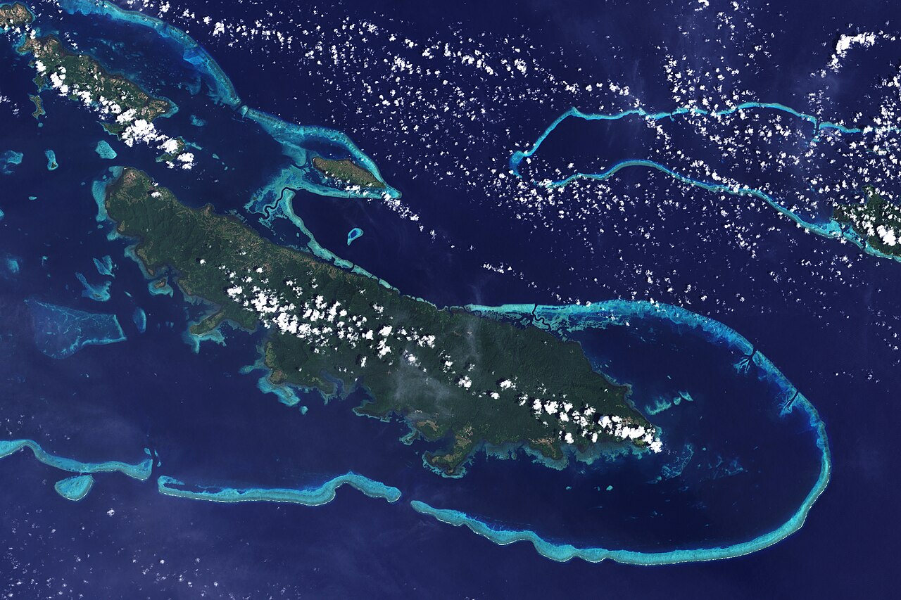 |
| Vanatinai Island, Papua New Guinea. NASA |
A formation of rock deposited in shallow water by biological activity. On Earth this is typically done by corals, which form calcium carbonate skeletons for protection and access to sunlight that then gradually build up, centimeters per year, into structures 10s to 100s of m high. But sponges and algae can also build reefs—if much slower—and did so long before corals evolved, so its no big stretch to imagine similar life could arise elsewhere.
Some corals have adapted to cold and deep water (these don’t often form large reefs), but for the most part the symbiotic photosynthetic microbes that they rely on limit corals to warm, shallow waters; generally above 18 °C year-round, rarely in areas with upwelling of cold water (consult Part VIb for guidance on the conditions for upwelling), and less than 50 m from the surface. As such, young reefs usually form fringing reefs directly along the coast, beginning just beyond the low-tide line. They extend further out as they age and more coral grows along the outer flank of the reef, and currents along the inner edge may erode out a channel or lagoon along the shore.
 |
| Structure of a mature fringing reef. USGS |
Coral does not grow above sea level, but sea level fall (which can be caused by local uplift even if global sea level is rising) may expose the reef, forming a coral island. Sand may also gather on a reef to form an island called a cay or key, which may grow large enough to support plant life and human settlement.
Put it all together, and the formation of cays on barrier reefs can occasionally form archipelagos of small, sandy islands offshore of tropical coasts with broad continental shelves.
Examples: Great Barrier Reef (Australia), Florida Keys (US), Belize Barrier Reef
Dimensions: Fringing reefs typically reach 10s to 100s of m from shore, up to several km. The Great Barrier Reef extends for over 2,300 km, reaching as far as 250 km from the coast into water 100s of m deep, and contains hundreds of islands, though few are over 1 km across. The Florida Keys, which lie in shallower waters and so more easily form large islands, extend for 300 km along Florida’s south coast and contain islands up to 20 km long and at most 6 m high.
Impact: Coral reefs are among the most ecologically diverse regions of the ocean; the corals and algae that gather on them provide food for many other organisms (the coral itself mostly relies on the symbiotic microbes for food, and recycles nutrients pretty efficiently such that they can grow in very nutrient-poor waters) and the reefs provide shelter for many young or slow-swimming animals. This, of course, also makes them good sites for fishing from small boats, diving for shellfish, or tourism. The coral itself is widely used for jewelry and art. A near-shore barrier reef or mature fringing reef can also help protect the shore from large ocean waves or storm surges.
But for larger ocean-going vessels, reefs can be major hazards, as they can be hard to spot from above the water but will tear open or entrap ships that run into them. Ports in areas with reefs may need to map out clear paths for shipping, or even clear away sections of reef. But because reefs grow so slowly, such damage can have lasting ecological consequences, and coral is particularly sensitive to shifts in ocean temperatures and chemistry.
Atoll
 |
| Fakaofo Atoll, Tokelau. NASA |
A shallow lagoon ringed by reefs, often topped by cays or coral islands, occasionally found far from any large landmasses. These are the remnants of extinct volcanoes, either from hotspots or subduction zones. The reefs initially formed as fringing reefs along the shore of the volcanic island. Once the volcano goes extinct, the island mostly erodes away, but the reefs remain and build up into barrier reefs as the island subsides or sea level rises.
 |
| Formation of an atol from a volcanic island. USGS |
Examples: Kwajalein (Pacific), Wake Island (Pacific), the Maldives (Indian Ocean),
Dimensions: Atolls can be hundreds of km across and thousands of square miles in area, but the islands themselves are rarely more than 100 km2 and often much smaller—the smallest atolls can be less than 1 km across. Atoll islands are typically less than 10 m high across most of their area, but uplift or sea level fall can raise them some several hundred meters.
Impact: Though small, atoll islands are often the only land available in vast areas of the ocean. They may be important nesting sites for flying or amphibious animals, and maritime societies may settle on them. More recently, some atolls have become strategic sites for naval or air stations.
Submarine Terrain
.jpg/1280px-Vailulu'u_vents_(Expl1546_9667420444).jpg) |
| Vailulu'u Seamount, Pacific. NOAA |
I’m generally assuming here that we’re most interested in the terrain on land, and that we’ll eventually build our civilizations there—and for my part, I don’t plan on getting too detailed about the terrain below the water on Teacup Ae. But in case anyone is a bit more interested in that, I’ll do a quick overview of the major features of submarine terrain—that of the ocean floor. I’ll cover both the major regions of the ocean floor and a few common “landforms”, including both primarily tectonic or volcanic and erosional or depositional features.
 |
| Distribution of elevation on Earth's surface (essentially, the shape of the line you'd get if you lined up all points on Earth in a row). NOAA |
Continental Margin
The coasts of the continents are mostly surrounded by the continental shelf, submerged sections of continental crust. The shelf is fairly shallow, with slopes under 1°—steepest along the coasts, and then flattening out.
The continental shelf ends at the shelf break, which is pretty uniformly at about 140 m below sea level all across Earth—likely representing the lowest sea level in recent history (as fluvial erosion has shallowed out areas above this level but left areas below it untouched). The ocean floor then transitions to the steeper continental slope, with a gradient of around 3° on average but over 10° along some active margins.
 |
| Interiot, Wikimedia |
Dimensions: The continental shelf is mostly under 100 m deep and extends around 100 km from the coasts along passive margins, in some cases reaching up to 1,500 km; and 20 km along active margins, in some cases essentially absent with coastal slopes plunging straight down into deep waters. As mentioned, the shelf break is usually 140 m deep, and the continental slope is usually 1-5 km tall and 10s to 100s of km broad, with the continental rise extending for up to 100s of km at its base.
Impact: The continental shelf supports the most productive and diverse marine ecosystems: the seafloor is shallow enough to support photosynthetic coral and plants, which in turn provide shelter for a variety of crawling and burrowing animals, and the water is often rich with nutrients discharged from rivers. This productivity, as well as the high rate of deposition here compared to most of the ocean and stability of rock—without much risk of subduction—also means that oil deposits form mostly on continental shelfs (though of course the area may no longer be a shelf by the time the oil is extracted).
Past the shelf break, light quickly attenuates in deeper water, and marine diversity declines with it; very little photosynthesis occurs in waters deeper than 200 m, and almost none past 1 km. Plankton suspended in shallow water can support open-ocean ecosystems, and the “marine snow” of dead material that sinks from those ecosystems can support some life on the deep seafloor. Generally more of this material is available closer to shore (and the supply of nutrients from rivers) and there are usually upwelling or downwelling currents that can be used for filter-feeding, so the continental slope tends to support more life than deeper water.
Submarine Canyon
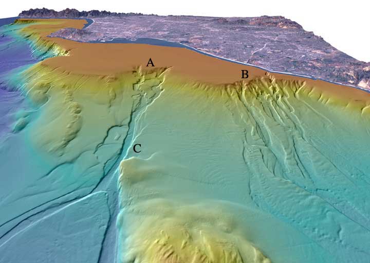 |
| Off the coast of Los Angeles. USGS |
Deep channels cut into continental shelfs and slopes, sometimes cutting km below the surrounding seafloor. These are typically found offshore of major river estuaries but extend far too deep to have ever been above sea level, so are believed to be caused by undersea currents created by the influx of sediment-laden water from the rivers.
Abyssal Fan
 |
| Source |
Cones of sediment deposited on the continental rise and slope, often at the ends of submarine canyons. Essentially, the submarine equivalents of alluvial fans, but these can be thousands of km across.
Abyssal Plain
The flat terrain across much of the ocean floor, far from the continents. Most of the seafloor is covered in thick beds of sediment and there’s little movement to disturb it. Water temperature is typically a few degrees above freezing.
Most of the abyssal plain is a featureless desert, inhabited by slow-moving animals that feed on the steady stream of “marine snow” drifting down from the more productive waters above. But near plate boundaries or hotspots, hydrothermal vents may form where water and other fluids heated by shallow pockets of magma rises through faults and erupts through the surface—like hot springs on land. The fluid is often rich with metals that may deposit nearby, often forming “chimneys” around the vent itself that can reach over 60 m high before ultimately collapsing. Chemosynthetic microbes can also extract energy by oxidizing these metals, and in turn support a diverse ecosystem of animals. A variety of species have adapted to live in the hot water near the vent, which can reach over 400 °C (prevented from boiling by the high pressure and salinity).
 |
| Vents near the Mid-Atlantic Ridge. MARUM |
Farther afield, cold seeps may form where tectonic faulting allows oil, methane, or sulfide compounds to escape from pockets in the crust (“cold” relative to hydrothermal vents; the fluid is still usually hotter than the ocean water, up to 60 °C). The fluid is often salt-rich as well, forming brine pools of highly saline water that appear like odd underwater lakes. Here, too, chemosynthetic microbes can feed off the fluid and support rich ecosystems around the seep.
 |
| Mussel beds alongside a brine pool in the Gulf of Mexico. Hovland 2015 |
Dimensions: Typically 3 to 6 km deep and covering around half of Earth’s total surface area.
Impact: Ephemeral as life here may appear, the plains are vast and life here plays an important role in cycling of marine nutrients and maintaining overall ocean chemistry. Some groups in recent years have proposed extracting the metal-rich deposits in parts of these plains, but this risks damaging ecosystems that may take centuries to recover.
Hydrothermal vents and cold seeps support unique ecosystems, the former perhaps the most isolated from sunlight of any surface life. They may also be the oldest ecosystems on Earth according to some models for abiogenesis (conceptually, anyway; individual hydrothermal vents likely only remain active for a few thousand years at most).
Mid-Ocean Ridge
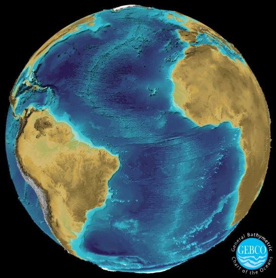 |
| Mid-Atlantic Ridge. GEBCO |
 |
| 37ophiuchi BrucePL, Wikimedia |
Rates of actual spreading and volcanic activity will vary for a variety of reasons, so often rather than a smooth slope there are a number of parallel ridges and valleys centered on the plate boundary. A fast-spreading ridge will usually have a single ridgeline at the center with frequent lava flow from the mantle, but a slower-spreading one will often have a rift valley like those at continental rifts that is only occasionally filled in with lava to form a new ridgeline.
As tectonic plates move and twist over the curved surface of the Earth, different areas of a ridge must spread at different rates, and so the seafloor near the ridge often fractures to form numerous transform faults. The position of the ridge itself may become offset between these faults, giving the ridge a distinct zig-zag appearance.
In addition to the major ridges, small temporary ridges may form in some regions, accomodating back-arc spreading or stresses within a plate, and then go extinct shortly after. Whether or not you count these as proper tectonic plate boundaries is largely a semantic choice.
There seems to be a common misconception that ridges may form volcanic islands like a divergent boundary, but there’s no such tendency; the highest parts of the ridge usually remain over 2 km below sea level and—bizarre pseudoscientific ideas about Atlantis notwithstanding—there’s no reason to think they’d get much higher. Where a hotspot meets the ridge, it may form an island like Iceland, but this is by no means common. Of course, the story may be different on a world with far shallower oceans.
Examples: Mid Atlantic Ridge, East Pacific Rise, Aden Ridge (Gulf of Aden)
Dimensions: Ridges are generally around 2.6 km below sea level and 2 km above the surrounding abyssal plain. The slopes extend out 100s to 1,000s of km to either side depending on the rate of spreading, with ridges and valleys up to 1 km in height or depth, taller near the ridge itself. A single ridge can extend 10,000s of km.
Seamount
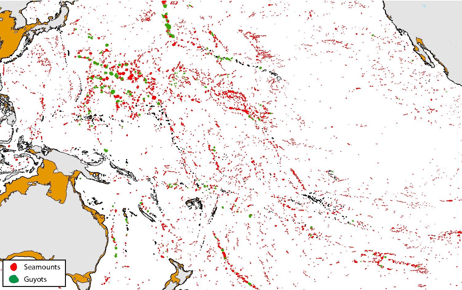 |
| Seamounts in the Pacific. Peter THaris, Wikimedia |
 |
| Bear Seamount, North Atlantic. NOAA |
Dimensions: Usually 1-4 km above the seafloor. There are over 14,000 on Earth, covering roughly 5% of the seafloor.
Impact: Seamounts tend to support more life than the surrounding open ocean, both because they provide some access for seafloor life to shallower waters and open ocean life to shelter; and because they tend to disturb deep-ocean currents in a way that creates upwelling of nutrient-rich water, feeding filter-feeders on their flanks and plankton in the waters above. A young seamount may also still have volcanic activity feeding hydrothermal vents.
Submarine Plateau
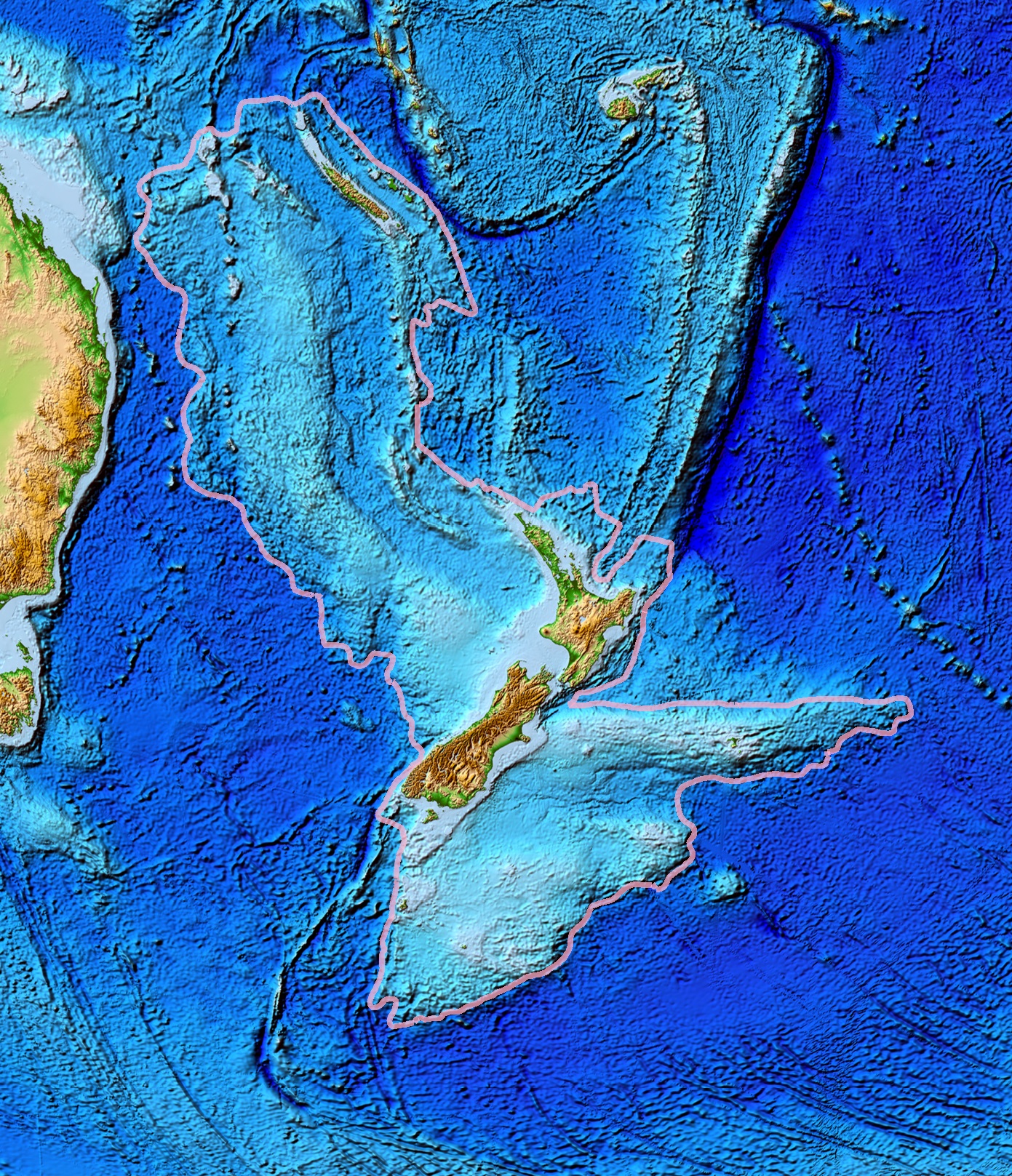 |
| "Zealandia". NOAA |
A broad rise on the ocean floor larger than a seamount, generally with a flattish top rather than a single peak.
Mostly these are the remnants of LIP (large igneous province) events on the seafloor. The young rock, though chemically similar to oceanic crust, is hotter and more buoyant, so if a plateau is pulled into a subduction zone shortly after forming it may actually resist subduction and instead “dock” itself to the side of a continent, remaining either as a sort of terrace along the continental slope or eventually being pushed up above sea level to form a part of the continent itself.
 |
| Process of docking of a terrane (an island arc here, but it's much the same for submarine plateaus), with subduction continuing behind it. Actualist, Wikimedia |
A few plateaus are also small sections of continental crust that have broken away from the larger continents and then subsided or eroded below sea level, sometimes with a few remnant islands.
Examples: “Zealandia” (South Pacific, continental), Rockall Plateau (North Atlantic, continental), Kerguelen Plateau (Indian, oceanic), Azores Plateau (North Atlantic, oceanic)
Dimensions: Up to 1,000s of km across and typically 2-3 km above the abyssal plain, though continental plateaus can be as shallow as continental shelfs. Altogether they account for about another 5% of the ocean floor.
Ocean Trench
 |
| Puerto Rico trench (exagerrated relief). USGS |
The deepest parts of the oceans, formed along subduction zones. As one tectonic plate subducts under another, the edges of both plates are dragged down, forming a deep assymetric gorge with slopes of around 5° on the subducting side and 10-20° on the overlaying plate.
The bottom of the trench is covered in sediment, so there’s no real gap between the plates where lava might emerge. But cold seeps are usually present on the steeper face, and some life lives even in the deepest section of the trench; even past the bottom of the trench, some microbial communities may inhabit the hot sediments between the plates.
Examples: Marianas Trench (West Pacific), Puerto Rico Trench (West Atlantic), Aleutian Trench (North Pacific)
Dimensions: Usually around 200 km from the parallel volcanic arc, about 50-100 km wide and 4 km deeper than the abyssal plain. Challenger Deep in the Marianas trench reaches to about 11 km below sea level.
In Summary
A fair number of the landforms I’ve mentioned are too small or subtle to include on most maps, but hopefully I’ve given you a general idea of how different erosive forces create the different landscapes we see on Earth. As I’ve written this, I’ve become more convinced I should add an additional post specifically discussing geologically processes that don’t occur on Earth but may create interesting landforms on other bodies.
For now, the plan is still for the next post to be a practical tutorial on creating a global terrain map that showcases many of the landforms we’ve discussed. Because of limitations in the software available, though, I’m still working out the process, and the ultimate result is likely to lean a little more towards artistically replicating these features rather than actually emulating the real processes that create them. But we’ll have to see when we get there.
- Erosional forces will tend to remove sediment from high or protruding regions created by tectonic forces and deposit it in lower or more sheltered regions, flattening out terrain over time.
- Fluvial erosion is driven by the flow of water in rivers and streams.
- Rivers will tend to converge and not diverge, flow into the sea, flatten out over their coarse, and not pass across highland regions, but there are various exceptions.
- Rivers will carve out converging patterns of v-shaped valleys, usually in a dendritic pattern.
- Uplift and erosion in dry regions will create first canyons, then badlands
- When flowing over sediment, rivers will form meanders that deepen over time, forming braided rivers in areas with greater slopes or less stable soil, and then meandering rivers on flat plains.
- Meandering and flooding may create temporary anabranches, river islands, or oxbow lakes.
- Migration of the river or periodic flooding may create a broad floodplain around a river.
- Tectonic, glacial, and other forces may create basins that form lakes, but eventually these will erode down their outlet or fill in with sediment.
- Slow-moving water can create wetland regions with diverse life.
- Irregular erosion through limestone or other weak rock can create karst structures and caves.
- Glacial erosion is driven by movement of ice and meltwater.
- Large glaciers can push down the land below them, and it can take thousands of years for it to rebound afterwards.
- Mountain glaciers form in mountain valleys and flow downhill like rivers, while continental glaciers form in cold regions and spread outwards in all directions.
- A mountain glacier carves a broad, steeped-walled U-shaped valley, which can contain streams, lakes, and fjords.
- Sediment pushed in front of a glacier will be left as a moraine after it retreats.
- Various types of hills and lakes are left in a glacier’s wake as it retreats, forming an irregular “hummocky” landscape.
- Meltwater trapped behind a glacier can escape as a cataclysmic jökulhlaup.
- Eolian erosion is driven by wind in the absence of fluvial or glacial erosion
- Areas with low precipitation relative to evaporation can form endorheic basins with no drainage out to the sea.
- Loose soil transported by winds often gathers to form dunes and other bedforms.
- Water escaping from aquifers can create rich oases in otherwise dry areas.
- Coastal erosion is driven by a combination of waves, tides, and currents, and its effect often depends on the sediment supply of nearby rivers.
- Waves tend to be strongest on large bodies of water with strong onshore winds, and a consistent wind direction can drive longshore drift.
- Tides tend to be strongest in the oceanwhere converging coastlines create a funnel shape.
- Sediment supply tends to be highest on passive margin coasts where there are rivers with large drainage basins that include young mountain ranges.
- Coasts with low sediment supply and strong wave action will tend to form cliffs, sometimes with wave-cut platforms, while those with more sediment will form beaches.
- Flooding behind a beach can form a lagoon with salt marshes or mangrove forests, leaving the beach as a string of barrier islands.
- Recent sea level rise has flooded into many river valleys to form rias, but rivers with high sediment supply have filled these in and formed deltas, which may have a variety of shapes and features depending on the relative influence of waves and tides.
- Coral reefs will form along tropical coasts, and shifts in sea level may form barrier reefs and atolls.
- Though erosion is weak on the seafloor, there are a few unique features:
- Continental margins will have a shallow continental shelf that is broader along passive margins, then a steeper continental slope and shallower continental rise.
- Most of the ocean is covered in the deep abyssal plain, which is poor in life save for at hydrothermal vents and cold seeps.
- Mid-ocean ridges appear at divergent boundaries, often with parallel ridges and a zig-zag shape.
- Seamounts form similarly to volcanic islands but are far more numerous.
- Submarine plateaus can form due to either volcanic activity or rifting of small sections of continent.
- Ocean trenches form at convergent boundaries, with a deep, asymmetric gorge.
Notes
There are numerous terms for landforms referring to features with specific shapes, or specific interactions between features, or only applying within particular geographic regions. Because I’ve been categorizing landforms more in terms of their formation and trying to not get too lost in the fine details, I’ve skipped over many of these essentially aesthetic variations; but it may be worth perusing through them to help spice up your writing.
This is a pretty good breakdown of how different influences shape the morphology of river deltas—and yes, I’ve shamelessly cribbed many of their images and examples for my treatment of them.
There’s a (possibly apocryphal) story in my family of some relative who had a house on Long Island on one of the barrier islands, went away during a big storm (perhaps the one in ’38?) and came back to find that not only was the house gone, but the land it had stood on was gone.


.jpg)
.jpg)
.jpg)
.jpg)
,_by_Klugschnacker_in_Wikipedia_(31).JPG)
_-_geograph.org.uk_-_849913.jpg)
.jpg)
this post is so informative! It requires me to spend much time focusing to understand more deeply.
ReplyDeleteWas the Black Sea an endorheic basin during the ice ages? I thought it emptied through a river into the Mediterranean. This would require the Turkish straits to be deeper than the lowest level of the Black Sea. I have not found any information on the later.
ReplyDeleteAre you going to address the location of mineral and ore deposits in the Teacup system? How they are formed and the details about the Goldschmidt classification. I was thinking of an almost entirely metallic planet made of stable elements heaver than iron by volume, and whatever it is possible to naturally form.
ReplyDeleteHave you mentioned any answers yet?
Delete